Unlock highly accurate and detailed project data with Castle Surveys’ precision 3D laser scanning services. Our advanced digital twin technology captures precise measurements and complex structures, providing reliable insights for architects, engineers and developers.
3D laser scanning surveys are currently setting new standards of efficiency when it comes to reliable and accurate surveying information. At Castle Surveys Ltd., we’re proud to be at the cutting edge of this ever-evolving technology and use fleet of Leica RTC 360’s and Riegl VZ600i Laser Scanners to accurately map even vast landscapes for purposes including measured building surveys, floor plans, and building information modelling or scan 2 BIM. Enjoy precision and lasting digital transformation for your projects when you get in touch to discuss our laser scanning services.
What is 3D Laser Scanning?
Accurate spatial data is key to achieving outcomes in today’s fast-paced world of agriculture and construction. 3D terrestrial laser scanning (TLS) is an ever-evolving technique for quickly and efficiently capturing geospatial understanding with unparalleled precision.
3D scanning technology uses LiDAR scanning (light detection and ranging) techniques to quickly collect detailed point cloud data from any landscape. Reality capture processes turn this data into the seamless 3D models that are currently transforming surveying methods across the industry.
Whether you’re working with design, planning, or execution workflows, 3D scanning technology can simplify your processes, drive informed decision-making, and significantly enhance your understanding of landscapes and their potential within your project.

An Overview of the Technology
Our 3D laser scanning services work by emitting rapid laser beams that reflect off surfaces and return to the scanner. The system records millions of data points every second, creating an incredibly accurate digital representation of landscapes, structures or objects – a great non-invasive way to capture critical spatial information.
How LiDAR Surveys Work
LiDAR surveys (Light Detection and Ranging) offer a specialised form of 3D laser scanning, using laser light for the precise data capture of distance measurements. By analysing the amount of time it takes for every laser pulse to return to the scanner, LiDAR systems can offer highly detailed 3D modelling solutions and topographic maps – making this approach particularly valuable for large-scale projects like infrastructure assessments, land surveys and environmental studies.
The Role of Reality Capture and Digital Twins
Reality capture creates seamless real-time 3D replicas, or digital twins, of a landscape using laser scans. This dynamic digital twin creation has become a modern cornerstone to success across the AEC (agriculture, engineering, construction) industry, replacing static data models with a much-needed dynamic approach.
Digital twins can serve to inform various processes throughout a project, such as the simulation of planned works, the detailed analysis of an environment’s potential, and even the ongoing remote predictive management of an environmental asset throughout its lifecycle. In other words, digital twins have the potential to significantly improve project outcomes.
Digital twins apply to industries including construction, maintenance, and long-term asset management, where they can be used to inform building models, infrastructural elements, and even complex interconnected systems like roads and railway networks.
Benefits of 3D Laser Scanning
Here at Castle Survey Ltd., we provide the accurate and reliable surveying data that you need to truly transform your processes. We produce efficient high-density point cloud data using cutting-edge equipment including our fleet of Leica RTC 360’s and Riegl VZ600i Laser Scanners.
From the moment you get in touch with our expert team, you can enjoy a seamless experience across the entirety of a 3D survey that benefits from –
High-Resolution Accuracy
Our 3D laser scans provide you with unparalleled precision, regardless of difficult terrain and other obstacles. Our cutting-edge equipment and expert processes provide high-resolution reality capture with millimeter accuracy that ensures unrivalled project accuracy every time.
Efficiency in Data Collection
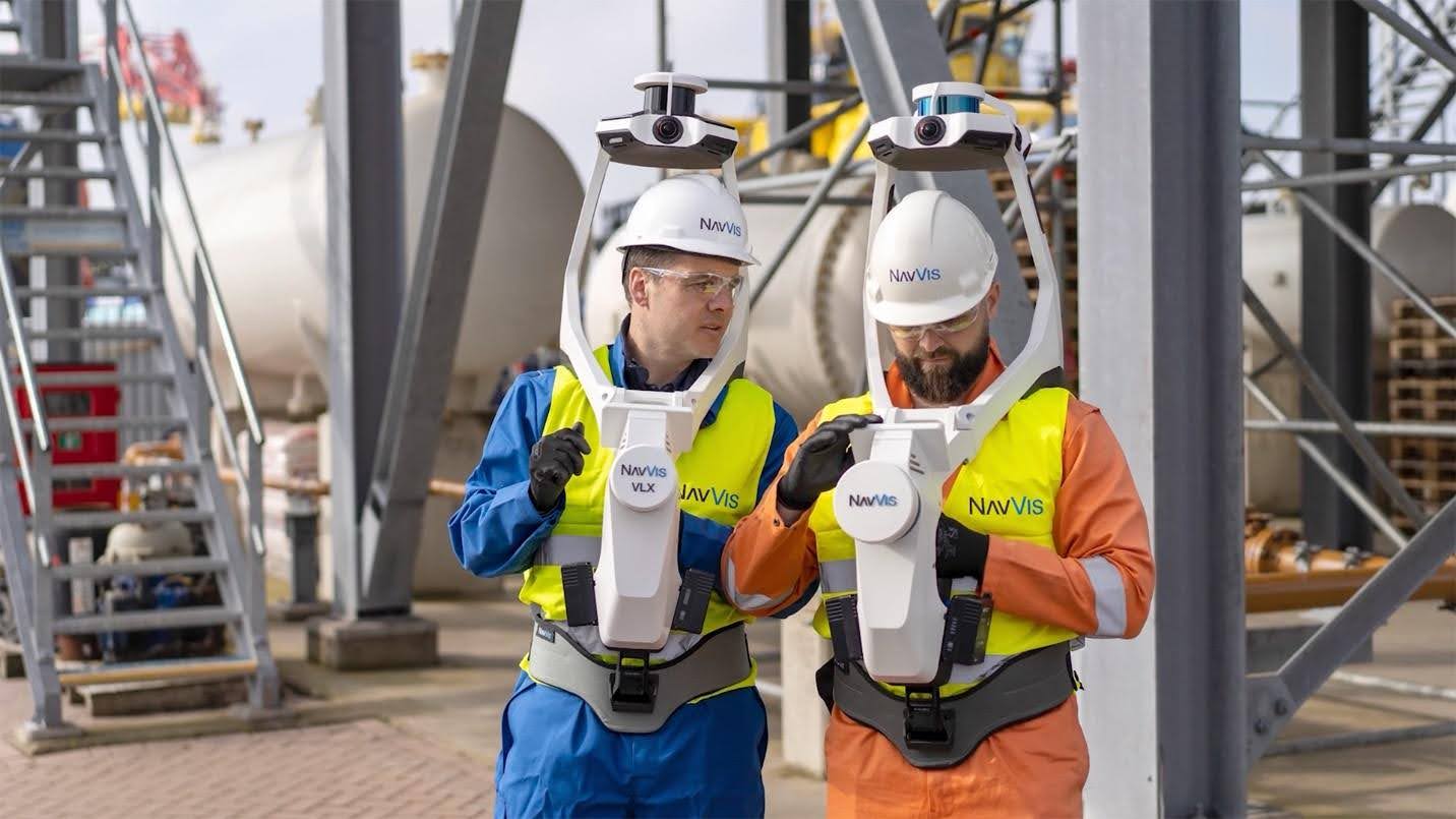
Are you worried that a detailed 3D laser survey will leave your site out of action for extended periods? Don’t be. Our use of equipment including Leica and NavVis VLX scanners means we can collect all of the data we need without once getting in your way. Our processes are quick, efficient, and designed to work for you rather than against you.
Reliable deliverables
We provide a range of high-quality survey deliverables, including BIM-ready models, digital twins, and point clouds that are always tailored to your project, needs, and preferences.
Versatility Across Applications
This approach can be used across multiple industries. In construction, it ensures accurate site assessments and progress monitoring. In renovation projects, it helps create precise models for retrofitting and refurbishments. For heritage and conservation projects, it captures detailed records of historical sites, preserving valuable architectural details for future work.
Enhanced decision making
Enhance project decision-making with our data-driven insights, which can inform effective planning and management across the entirety of projects such as new builds, renovations, and even difficult restorations.

Our 3D Laser Scanning Process
We follow a structured and efficient approach to our 3D laser scanning services, which consists of three key stages:
Initial Consultation and Planning
Before scanning begins, we work closely with our clients to understand their specific project requirements. During the consultation phase, we outline key objectives, assess the site and determine the best scanning approach. Whatever the project size and type, we tailor our services to meet your exact needs.
Data Capture and Processing
Using our state-of-the-art 3D survey technology we conduct a thorough site survey, capturing millions of high-resolution spatial data points with incredible accuracy. Once the data from point cloud surveys or LiDAR surveys is collected, it is processed using advanced software to create a precise point cloud, forming the basis for 3D models, topographic maps and other deliverables.
Deliverables and Reporting
We provide clients with high-quality outputs tailored to their project needs. These may include detailed 3D models, BIM-ready datasets, CAD drawings and topographical maps, all offering actionable insights and giving you the information you need to proceed with confidence.
Applications of 3D Laser Scanning
Ever-evolving 3D laser scans are continually informing surveying processes across sectors including agriculture, civil engineering and even healthcare or retail.
Just a few notable applications of 3D laser scanning in recent years include –
As-built documentation and BIM Integration
3D mapping and modelling enable the simple integration of as-built documentation such as building drawings and surveys and digital BIM (business information modelling) representations to provide accurate, real-time project management and construction processes across new builds, renovations, and more.
Heritage Preservation and Restoration project
High-definition surveying software that efficiently maps the condition, layout and features of historic or heritage buildings can transform preservation and restoration projects. Using this technology, it’s possible to both manage heritage assets and digitally visualise reconstructions from start to finish.
Infrastructure projects
Infrastructure projects that include bridges, tunnels, and railways can benefit from 3D laser scanning that informs highly accurate planning across both existing and new installations regardless of difficult terrain or obstacles like rivers and pipelines.
Industrial facilities and plant maintenance
3D laser scanning technologies are currently contributing to industrial design, construction, and operations, and can be effective for purposes including risk mitigation, minimising project disruption, and continually monitoring site safety and operations.
What is a Point Cloud Survey?
In the fascinating world of 3D data, a point cloud survey is a collection of data points in space. Each point in the cloud represents a single measurement from a 3D scanning device, such as a LiDAR scanner or a photogrammetry setup. Together, these points map out the surface of an object or environment, capturing its shape and features with impressive detail.
Benefits of Using Point Clouds
- High Precision: Point clouds provide an incredibly detailed and accurate representation of physical spaces.
- Versatility: They can be used across various industries, from construction to entertainment.
- Cost-Effective: By reducing the need for physical prototypes and site visits, point clouds save time and resources.
How Are Point Clouds Generated?
The generation of a point cloud typically involves scanning an object or environment using devices like LiDAR (Light Detection and Ranging) or photogrammetry cameras. These devices measure distances and angles, capturing millions of points that collectively form a dense “cloud.” Advanced software processes these points, creating a detailed 3D model that can be manipulated and analysed.
Why Choose Castle Surveys?
Accuracy is paramount to extracting true and lasting value from 3D laser scans and choosing a reliable surveying company can make a huge difference to your project outcomes.
Here at Castle Surveys Ltd., we have proven expertise in 3D laser scanning and digital documentation that applies to a wide variety of construction industry uses. Simply tell us about your project goals, and our experts will provide you with a tailored solution that’s unique to your plans.
Our state-of-the-art equipment ensures quality results and unrivalled precision across versatile applications like infrastructure planning, real estate development, and even heritage preservation, regardless of obstacles like difficult terrain or pipework. We also publish all of our 3D laser scans through Leica TrueView, which enables quick, simple client and stakeholder web access to point clouds that you can easily explore and annotate for future discussions where required.
As well as our 3D laser scanning, we offer inclusive surveying services including land surveys, refit modelling, and site engineering. When you choose Castle Surveys Ltd, you can enjoy comprehensive outcomes, delivered by one of the fastest-growing multi-disciplinary surveying practices in the UK.
Precision is key to enhancing your project outcomes, and that’s exactly what you can expect when you seek innovative 3D laser scanning from Castle Surveys Ltd. Simply get in touch with our team to discuss your project today.
Get Started with 3D Laser Scanning
Looking to get started with your next 3D laser scanning project? Our expert team is here to help.
Schedule a Consultation
Ready to see how 3D laser scanning can enhance your project? Get in touch with Castle Surveys to discuss your requirements. Our team will guide you through the process, ensuring you get the most efficient and effective scanning solution, tailored to your needs.
Explore Related Services
Our 3D laser scanning services integrate seamlessly with our other specialist surveying solutions, including:
- BIM surveys: Transform point cloud data into intelligent 3D models for streamlined project collaboration. Explore our advanced BIM surveying solutions.
- Topographic land surveys: Capture accurate land data for planning, design and development projects. Learn more about our topographic land surveys.
- Measured building surveys: Obtain precise building dimensions for renovation, restoration or compliance. Find out how we deliver accurate measured building surveys.
Frequently Asked Questions about 3D Laser Scanning Surveys
CONTACT US