
PAS 128 Survey Types Explained: QL-A, QL-B, QL-C and QL-D
August 14, 2026 9:21 amBefore PAS 128 arrived, underground utility surveys were a bit of a lottery. Every survey firm had its own methods. Every deliverable looked different. And project managers had no consistent way of judging how much confidence to place in the lines on a drawing.
That’s the problem the BSI standard solved. PAS 128 is the UK specification for detecting, verifying and locating underground utilities, and it gives the industry a common language for data quality. Every buried service on a PAS 128 deliverable carries a quality level, from QL-D at the bottom to QL-A at the top. The higher the level, the more rigorous the method and the greater the confidence in the result.
Why does that matter? Because striking a buried cable or gas main isn’t just a programme delay, it’s a genuine threat to life, and HSG47 places a clear duty on you to manage that risk. Understanding the pas 128 survey types is how you specify the right level of certainty at the right stage of your project, without paying for precision you don’t yet need.
This guide breaks down all four quality levels, shows how they build on one another, and helps you choose the right strategy for your site.
Breaking Down the PAS 128 Survey Categories
The four categories aren’t competing products; they’re a hierarchy. Each level layers new evidence on top of the one below it, tightening confidence as you climb. Let’s start at the bottom and work up.
PAS 128 Type D Survey (QL-D): Desktop Records Search
A pas 128 type d survey involves no site work at all. It’s a desktop exercise: collecting and collating statutory utility records from asset owners (water, gas, electricity, telecoms and the rest) and compiling them into a single drawing of what’s believed to be under the ground.
Sounds comprehensive? It rarely is. Utility records are notorious for being outdated, incomplete, or drawn to a scale that makes positional accuracy meaningless. Services get diverted and never recorded. Older assets predate the records entirely. Some drawings we’ve requested have come back showing utilities in the middle of buildings that were demolished decades ago.
That’s why QL-D carries the lowest confidence rating of the four pas 128 survey types. It’s a valuable foundational baseline, and every higher-level survey starts here, but it should never, ever be relied on alone for live groundworks. Treat it as a list of suspects, not a map of facts.
PAS 128 Type C Survey (QL-C): Site Reconnaissance
A pas 128 type c survey builds directly on top of that desktop baseline. A surveyor visits the site and ground-truths the records against what’s physically visible: valve covers, inspection chambers, stop taps, marker posts, cabinets, and the tell-tale scar lines left by previous utility reinstatements in the road surface.
Where the visible evidence matches the records, confidence improves. Where a run of chambers appears that no record mentions… well, now you know the records are missing something, and that’s useful intelligence in itself.
The limitation is obvious once you say it out loud: QL-C can only confirm what leaves a trace at the surface. A hidden, unrecorded duct with no chambers, no covers and no scarring is completely invisible to a reconnaissance survey. It sharpens the desktop picture, but it can’t see underground.
PAS 128 Type B Survey (QL-B): Geophysical Detection
Now we get to the level where the technology comes out. A pas 128 survey category type b uses non-intrusive geophysical detection, specifically Ground Penetrating Radar (GPR) and Electromagnetic Location (EML), to scan beneath the surface and trace services directly, without breaking ground.
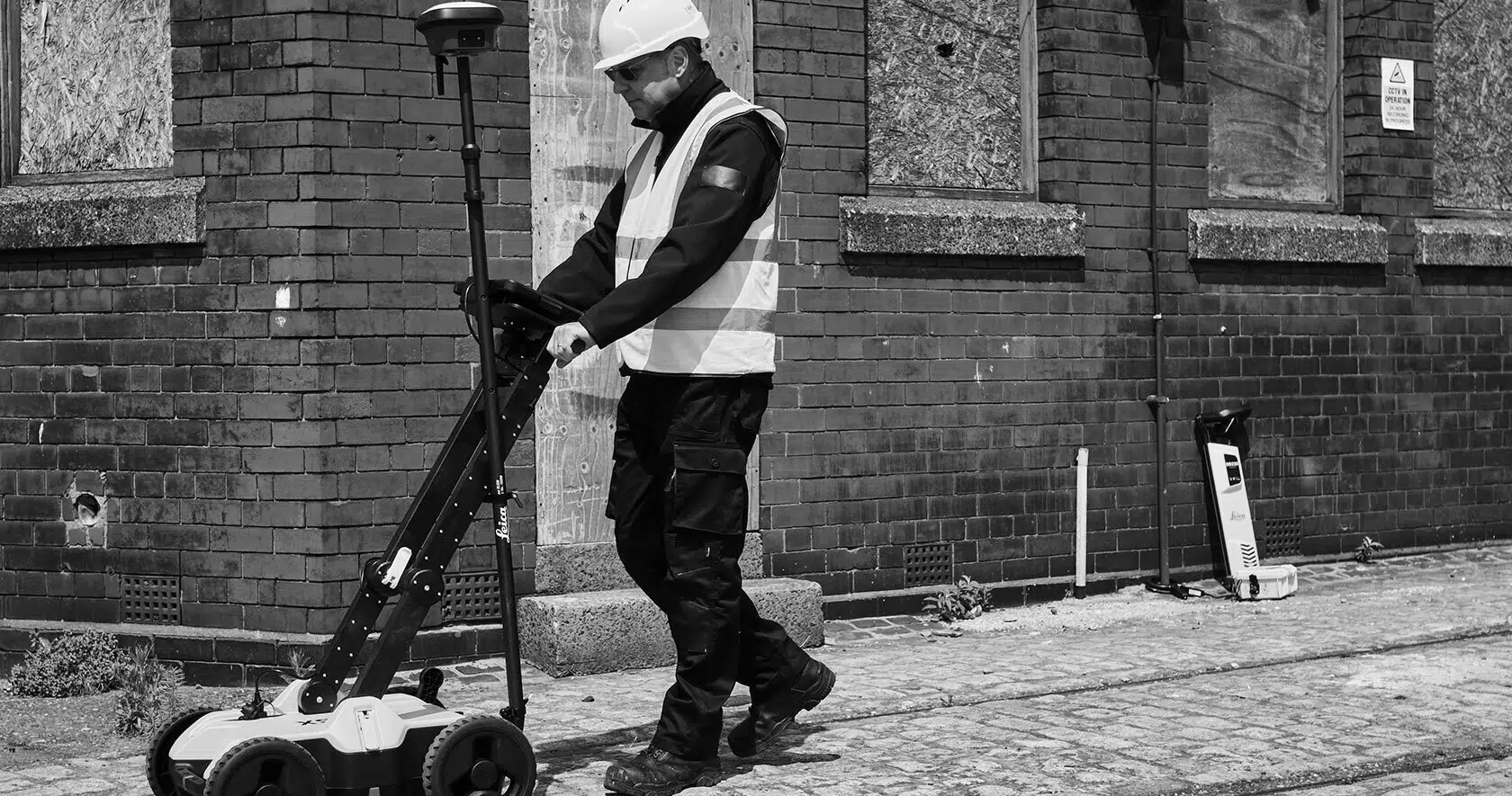
EML detects the electromagnetic fields around conductive services, either passively or by applying a signal to an accessible line. GPR fires radar pulses into the ground and reads the reflections, which is what picks up the non-conductive assets EML can’t see: plastic water pipes, clay drainage, empty ducts, fibre routes. Used together, the two techniques cover far more of what’s actually down there than either could alone. We run the IDS Stream C-thru towable GPR array for exactly this reason; a massed array of antennas captures dense, consistent data across a whole carriageway in a fraction of the time a single-channel unit would take.
In our experience, this is the absolute sweet spot for most UK construction sites. It’s the level that turns a drawing of assumptions into a drawing of detections, and it’s the standard most designers and contractors should be specifying at detailed design stage. If you want to see what a dedicated QL B survey involves in practice, we’ve broken it down in full.
One detail that catches people out: pas 128 type b results are further split into sub-levels, from B1 down to B4, and they’re not all equal. B1 is the gold standard within the category, indicating high confidence in both horizontal and vertical position, achieved through post-processed geophysical data. At the other end, B4 means a service is suspected to exist but couldn’t be geophysically tracked on site; it appears on the deliverable as an assumed line, not a detection. Two utilities on the same drawing can carry very different levels of certainty, so always read the quality level attached to each segment, not just the survey title on the drawing frame.
PAS 128 Type A Survey (QL-A): Physical Verification
QL-A is the top of the tree: the only level where the utility is physically seen. A pas 128 type a survey requires exposing the asset itself to verify its exact horizontal and vertical position, along with details no geophysical method can confirm from the surface, such as material type and diameter.
In practice, that verification usually means hand-dug trial pits or vacuum excavation at targeted locations, typically the specific conflict points where a proposed foundation, drainage run or piling position intersects a detected service. Vacuum excavation is the safer of the two around live assets; it exposes the utility without a spade ever touching it.
Nobody excavates an entire site to QL-A, and nobody should. It’s a targeted, surgical tool: expensive per location, but brilliant value at the handful of points where absolute certainty protects your programme and your workforce.
The Four PAS 128 Survey Types at a Glance
The pattern across the whole standard is simple: as you move from D up to A, the method gets more direct, the accuracy tightens, and the confidence in the data climbs. The “QL” terminology isn’t just jargon, either; it’s the structural language used in the final CAD deliverables, with each utility segment tagged with its quality level so anyone reading the drawing knows exactly how much to trust each line.
Here’s the whole framework in one view.
| Quality Level | Method | Accuracy | Ideal Project Phase |
| QL-D | Desktop search of statutory utility records | Unquantified; records often outdated or incomplete | Feasibility and early planning |
| QL-C | Site reconnaissance; records checked against visible surface features | Improved confidence, but limited to surface evidence | Planning and constraint identification |
| QL-B | Geophysical detection using GPR and EML (sub-levels B1 to B4) | Typically within ±250mm horizontally and ±40% of depth, tightening to around ±150mm and ±15% at B1 | Detailed design and procurement |
| QL-A | Physical exposure via trial pits or vacuum excavation | Highest available; position, depth, material and diameter verified visually | Pre-construction, at critical conflict points |
How to Choose the Right PAS 128 Quality Level for Your Project
So which level do you specify? In our experience it comes down to two vectors: where you are in the project lifecycle, and how much excavation risk the next phase carries. High-risk groundworks demand high-confidence data; early optioneering doesn’t.
A practical sequence we’d recommend to any civil engineer or utility project manager:
- Feasibility and planning: Combine Type D and Type C. The desktop records and a site walkover together identify the major structural constraints, the high-voltage cables, trunk mains and strategic assets that could shape or sink a scheme, before any serious design money is spent.
- Detailed design and procurement: Deploy a comprehensive Type B detection survey across the working area to map precise service pathways. This is where clashes get designed out, diversions get priced accurately, and contractors stop building risk premiums into their tenders for the great unknown below ground.
- Pre-construction and groundbreaking: Use targeted Type A verification at known utility intersections and high-density corridors. Exposing the critical assets before the excavators arrive protects your site workers and gives you the verified evidence HSG47 expects within a safe system of work.
Notice the shape of that sequence: broad and inexpensive early, precise and targeted late. Skipping straight to trial pits wastes money; stopping at desktop records gambles with safety. The standard works best when the levels are layered in order.
Getting Your Survey Scope Right
Every site is different, and honestly, that’s the whole reason specification matters. A greenfield solar farm, a live hospital campus and a Victorian high street each justify a completely different blend of quality levels, and getting that blend right is where an experienced survey partner earns their fee.
If you’re weighing up what your project needs, talk to us. Castle Surveys delivers every PAS 128 utility survey in-house, with no subcontracting, using GPR and EML equipment our own surveyors operate week in, week out on UK infrastructure and construction sites. Get in touch with the team to discuss your site parameters, establish the correct survey scope, or request a clear, compliant PAS 128 quote. No pressure, no jargon, just a straight answer on what your ground conditions actually call for.
Frequently Asked Questions
Can a utility survey map both metallic and non-metallic pipes?
Yes, provided the right combination of techniques is used. Electromagnetic location traces conductive services such as metal pipes and cables, but it can’t see plastic, clay or concrete assets at all. That’s where Ground Penetrating Radar comes in; GPR detects changes in the ground itself, so it picks up non-metallic pipes, ducts and voids that EML misses. A proper QL-B survey uses both together, which is exactly why the standard produces far more complete utility maps than a single-technique trace ever could.
Why can’t I just use a standard utility trace instead of a PAS 128 survey?
A basic trace, often a quick pass with a cable avoidance tool, has its place for spot checks, but it comes with no defined methodology, no accuracy classification and no auditable deliverable. You get some lines on the ground and no way of knowing how much to trust them. A PAS 128 survey gives every detected service a documented quality level, backed by a consistent, repeatable method. If an incident ever occurs, that audit trail is the difference between demonstrating a compliant, HSG47-aligned system of work and having nothing to show. For any project involving real excavation, the standard isn’t a luxury; it’s the baseline.
Comments are closed here.