
Understanding the Different Types of Land Surveys and Their Uses
May 27, 2025 10:00 amLand surveys are the foundation of accurate planning, safe construction, and informed decision‑making in the built environment. Whether you’re designing a new housing development, overseeing infrastructure upgrades, or managing large‑scale engineering works, understanding the types of land surveys available and their unique benefits is essential. At Castle Surveys Ltd, we provide a full suite of surveying services tailored to the needs of architects, planners, engineers, and construction professionals across the UK. In this article, we explain the key types of land surveys, their uses, and the technologies that underpin modern surveying methods.
Topographic Land Surveys
Topographic land surveys map both natural and man-made features of a site, such as buildings, trees, fences, paths, and changes in elevation. Topographic land surveys, along with detailed tree surveys for planning, are essential in the early stages of site planning and design, informing architects and engineers about the terrain and existing structures to prevent costly surprises later in the project.
Castle Surveys Ltd uses total stations, GNSS, and drone technology to produce accurate, high-resolution topographic maps in 2D or 3D formats. Precise topographic data is critical for everything from drainage design to landscape planning. According to RICS, early-stage topographic surveys can significantly reduce the likelihood of design errors and construction delays.
Measured Building Surveys
A measured building survey provides detailed internal and external dimensions of an existing structure, including walls, floors, windows, rooflines, and services. We use laser scanners to capture millions of data points per second, generating point clouds converted into floor plans, elevations, and 3D models. Measured building surveys reduce guesswork in the design phase and ensure compliance with planning regulations, which is especially important for heritage or listed buildings.
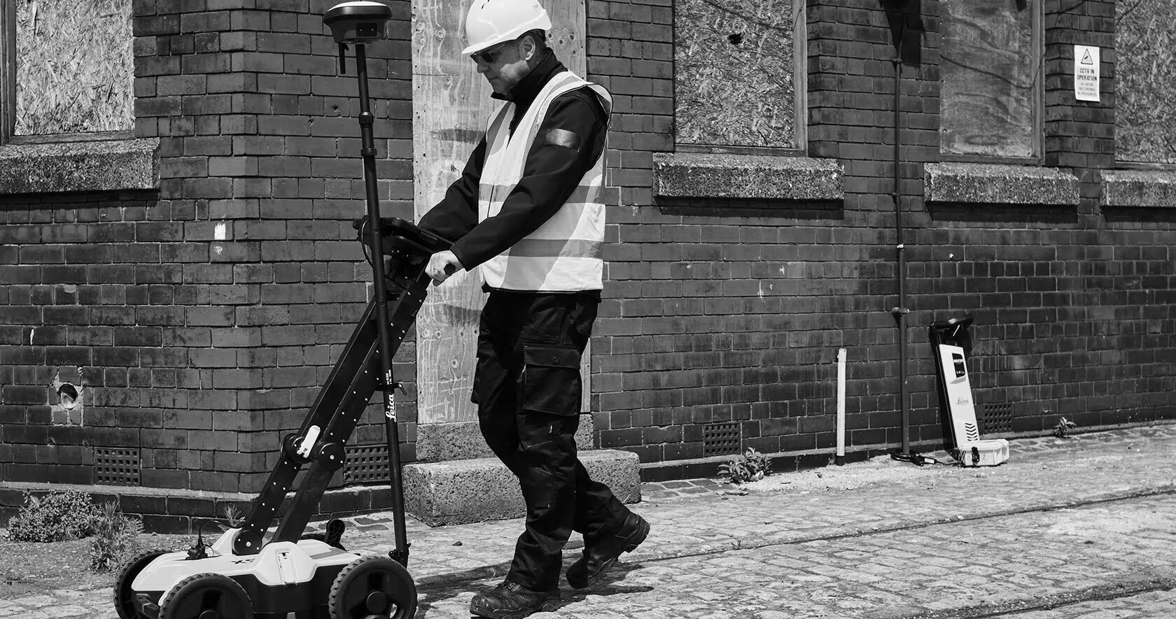
PAS128 Underground Utility Surveys
Identifying the location and depth of underground utilities is vital for safety and efficiency. PAS128‑compliant surveys follow the British Standard for underground utility detection. We use ground penetrating radar (GPR), electromagnetic locators, and verified records to detect and map underground features. PAS128 surveys significantly reduce the risk of utility strikes, which can lead to injuries, delays, and increased costs.
CCTV Drainage Surveys
CCTV drainage surveys use remote cameras to assess the condition and layout of underground drainage systems. High‑definition CCTV equipment provides real‑time footage of internal pipe conditions, accompanied by detailed survey reports with repair recommendations. Preventative inspection through CCTV surveys can avoid unexpected flooding or property damage, offering long‑term cost savings.
Site Engineering and Setting Out
Site engineering and setting out transfers design plans onto the ground, marking exact locations for foundations, roads, walls, and utilities. We use total stations and GNSS to mark precise coordinates on site. Accurate setting out ensures structures are built to the correct size, orientation, and location, avoiding compliance or alignment issues.
Mobile Mapping
Mobile mapping captures geospatial data rapidly with vehicle‑mounted systems. Our LiDAR, panoramic imagery, and GNSS system provides high‑speed, high‑accuracy data capture while in motion. Mobile mapping surveys large areas efficiently, saving time and minimising disruption to public access or traffic.
3D Laser Scanning
3D laser scanning captures detailed digital representations of physical environments for BIM, digital twins, or heritage preservation. We use phase‑based and time‑of‑flight laser scanners to build detailed point clouds processed into 3D models. Scanning improves data accuracy and efficiency and preserves historical details in a non‑invasive way.
Construction Verification
Construction verification ensures built works align with design and tolerances using laser scanning and digital models. Early identification of deviations allows timely corrections, reducing rework costs and keeping projects on schedule.
The Role of Digital Twins in Surveying
Digital twins—virtual replicas of physical assets—are created from topographic surveys, 3D scanning, and mobile mapping data. Digital twins enable real‑time monitoring and simulation for smart cities, asset management, and infrastructure planning. Digital twins lead to better operational decisions and can reduce lifecycle costs by up to 30%.
Why Work with Castle Surveys Ltd?
- Experienced site engineers and technicians
- Advanced technologies such as LiDAR, GPR, and mobile mapping
- Compliance with British Standards, including PAS128
- BIM‑ready outputs and integration with CAD and GIS systems
Get Clarity Before You Build
Accurate surveying is the foundation of every successful project. With a full range of services, Castle Surveys Ltd supports professionals in construction, planning, and engineering by providing reliable data and insight at every stage.
Speak to our team to find the right type of land survey for your next project.
This post was written by Paul Jackson
Comments are closed here.