Overhead Line Survey (OHL Survey) or Power Line Mapping Survey
May 6, 2025 5:48 pmOverhead Line Survey (OHL Survey) or Power Line Mapping Survey
As regulations tighten and infrastructure demands grow, there’s an increased need for power line management. Overhead line surveys play a huge role, and with advancements in mobile mapping technology, power line mapping is undergoing a revolutionary change. In this post, we’ll delve into the importance of overhead line surveys, the benefits of mobile mapping, and how modern technology is transforming the energy sector.
What is an Overhead Line Survey?
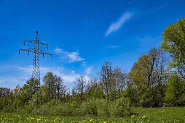
An overhead line survey maps and analyses power line infrastructure. Data is collected on line height, location and surrounding environment to ensure safety, regulatory compliance and operational efficiency. Surveys identify cable positions and document clearances from the ground, structures and vegetation. Environmental assessments analyse terrain and potential obstructions that could impact line integrity.
Applications of Overhead Power Line Surveys
Power line surveys detect wear and tear, cracks, erosion and malfunctions. Regular surveys help utility companies address issues early, preventing outages and disruptions. Survey data also guides capacity expansion and resource allocation decisions.
Accurate line mapping supports maintenance, infrastructure planning and emergency response. Technicians use precise data to plan repairs or upgrades without delay, while clear documentation prevents accidental damage to power lines.
3D mapping allows professionals to visualise cable placement and surrounding hazards. Overgrown vegetation, nearby structures or uneven terrain can cause outages, fires or safety hazards—highlighting the value of detailed mapping.
Height Clearance and Safety Compliance
Regulations mandate specific height clearances to prevent electrocution and vehicle damage. Proper clearance reduces outage risks from sagging lines and equipment. Overhead surveys ensure compliance, enhancing reliability and safety.

Methods of Conducting an Overhead Line Survey
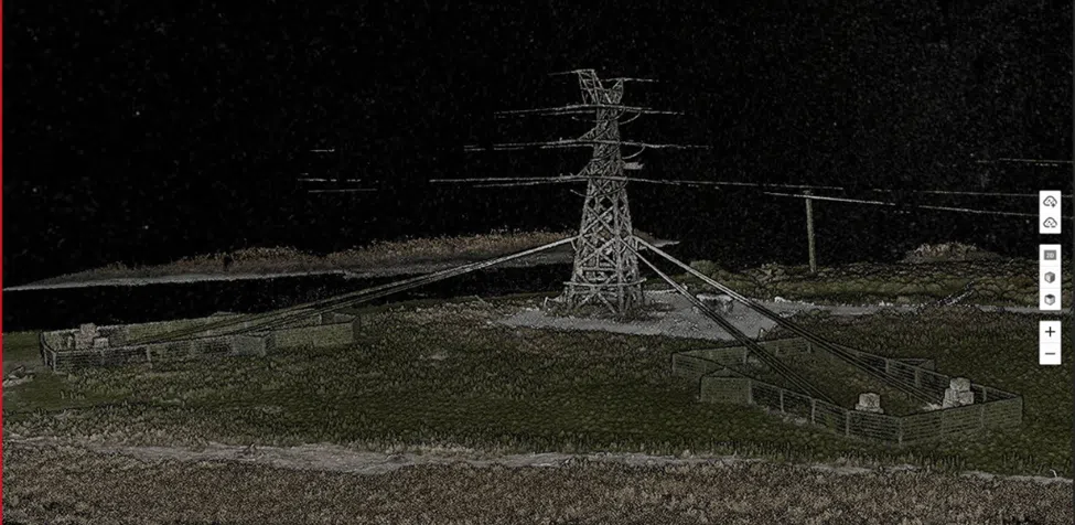
Traditional surveys involve walking line routes and manual documentation—a labour-intensive and time-consuming process. Aerial surveys use planes or helicopters to inspect large sections. Thermal imaging detects hot spots, indicating faulty connections. However, the most efficient method is mobile mapping with LiDAR technology, which accurately captures infrastructure, terrain and vegetation growth.
An Introduction to Mobile Mapping
Mobile mapping transforms power line surveys. Mounted on vehicles, backpacks or drones, LiDAR scanners and HD cameras capture geospatial data quickly and accurately. Unlike static setups, mobile mapping reduces human error and speeds data collection.
Benefits of Using Mobile Mapping for Power Line Surveys
- Reduces dangerous ground-based surveys in rural or rugged terrain.
- Achieves sub-centimetre accuracy (up to 10 mm), ideal for detailed mapping.
- Combines LiDAR with navigation sensors for fast data capture and processing.
- Integrates seamlessly with GIS platforms for advanced visualisation.
What is LiDAR Technology?
LiDAR (Light Detection and Ranging) emits laser pulses to measure distances and create 3D point clouds. High-frequency pulses yield dense, accurate models of environments. LiDAR-equipped mobile mapping units, like the Leica TRK, use GNSS, inertial sensors and cameras to capture huge datasets in seconds, ensuring sub-centimetre precision.
Industry Challenges Solved by Mobile Mapping
Mobile mapping addresses accessibility, inefficiency and accuracy issues in traditional surveys. Advanced units navigate obstacles safely, automate data classification and integrate with existing workflows for rapid, reliable results.
Why Choose the Leica TRK Mobile Mapping Unit?
The Leica TRK is a leading mobile mapping system with state-of-the-art IMU, GNSS and high-resolution imaging. It captures 360° panoramas and LiDAR point clouds simultaneously. AI-enabled data processing reduces manual effort, while its modular design mounts on varied platforms for versatile deployment.
Applications of the Leica TRK Across Different Sectors
The Leica TRK supports:
- Bridge and road network mapping
- Urban development and smart city models
- Environmental monitoring (vegetation, flood risk)
- Utility networks and power line management
Conclusion
LiDAR-enabled mobile overhead line surveys revolutionise power line mapping with unparalleled precision and efficiency. Utility companies benefit from high-quality data, reduced costs and streamlined workflows. As technology evolves, mobile OHL surveys will become the norm for ensuring a safe, reliable power grid.
Embrace modern mobile mapping—contact Castle Surveys Ltd to discuss your power line survey needs or explore our drone and mobile mapping services.
This post was written by Paul Jackson
Comments are closed here.