
Understanding Underground Utility Detection Techniques
August 16, 2025 10:03 amA struck gas main. A severed telecoms cable. A programme that stalls for weeks while everyone works out what just happened and who’s paying for it. That’s what’s at stake when underground utilities aren’t properly detected before the ground gets broken.
Understanding how detection actually works helps project teams commission the right survey for the job, and interpret the results with confidence rather than just taking them on trust. This article covers why accurate detection matters under UK regulation, the main techniques used, when they need combining, and what you can expect to receive once the survey’s done.
Why Accurately Locating Buried Services Matters in the UK
Mitigating Risks Under HSG47 and CDM 2015 Regulations
Hitting a live electrical cable, a gas main, or a high pressure water line isn’t just expensive, it’s genuinely dangerous. HSE guidance under HSG47 (Avoiding Danger from Underground Services) sets out the expectation that a pre-excavation survey happens before work begins, protecting site staff and avoiding the downtime that follows a strike. It’s a compliance requirement, but it’s also just good sense: nobody wants to be the one explaining how a digger found a gas main the hard way.
The Cost of Incomplete Desktop Searches
Historical utility records only tell you so much. Maps get outdated, services get diverted or abandoned without the paperwork catching up, and older sites in particular often carry infrastructure that simply doesn’t appear on record. That’s why physical detection matters: a desktop search is a useful starting point, not a substitute for actually scanning the ground.

Key Underground Utility Detection Techniques Explained
No single method detects every type of utility. A professional survey, carried out to PAS 128 survey specifications, uses a combination of techniques matched to the site and the services likely to be present.
Electromagnetic Induction
Our commitment to precision is reflected in our electromagnetic induction method at Castle Surveys. With sophisticated specialised tools, our experienced technicians utilise electromagnetic induction to produce a comprehensive map of the metallic utilities including water, gas, and also power lines. This technique works really well in the cities where there is a dense utility network that really needs to be mapped correctly. The waves that our technology transmits into the ground are altered due to the presence of metallic materials. We detect and analyse these changes using our equipment, which provides accurate information on the position, the depth, and even the kind of metallic utilities buried under the ground. This method is very essential for the prevention of costly damages and also for ensuring the safety of the workers during excavation projects.
Ground Penetrating Radar (GPR)
Another key component of our survey services is the Ground Penetrating Radar (GPR), which provides an underground x-ray-like level of detail. Using high-frequency radio waves, our GPR systems dig through the different ground types to unravel the secrets beneath. When the waves encounter other materials, such as non-metallic utilities like plastic pipes or fibre optics, they reflect back to the surface. This approach is very essential for complete utility mapping, not only showing the location but also giving useful information about the type of utility present. We constantly improve our GPR technology to provide the best-resolution images and accurate data, which helps in planning and preventing interruptions in utility services.
Acoustic Location
The acoustic location technology is used by Castle Surveys for the utilities that have escaped electromagnetic and radar detection. This method is especially useful for identifying and mapping non-metallic pipes, such as PVC or asbestos cement, which are quite very difficult to identify. The sound waves generated by our acoustic location devices are sent into the ground, which then reverberate off of the pipes. These resonances produce some distinct acoustic signatures that our equipment can sense and can analyse. Through the analysis of these acoustic patterns, we can precisely identify and map the non-metallic utilities, so that our surveys are as thorough as possible. This method is very critical for comprehensive utility detection, particularly in regions that have both old and new infrastructure.
Vacuum Excavation
Finally, the newly developed vacuum excavation completes our service package well. This non-destructive approach is the epitome of safety and accuracy in utility surveying. Utilising a combination of high-pressure air or water and a powerful vacuum system, we can gently yet effectively reveal the underground utilities. This approach provides a direct visual confirmation of the utility locations while also preserving them from any kind of damage. It is especially very beneficial in areas that are sensitive or where it is also too dangerous to use traditional methods of excavation. Vacuum excavation is the embodiment of our dedication to ensuring safety, effectiveness, and also minimally disruptive surveying practices.
When Should You Combine Techniques?
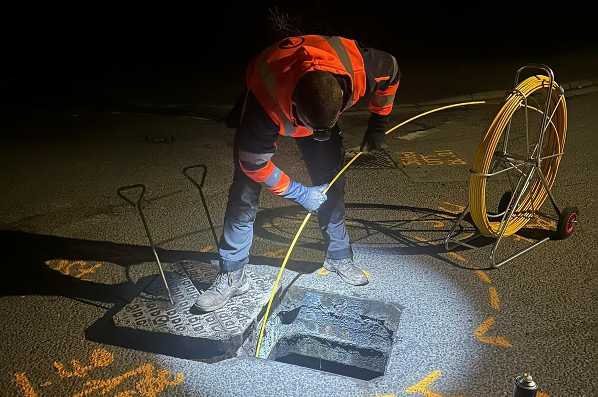
A PAS 128-compliant survey from Castle Surveys typically combines EML and GPR, because each covers the other’s blind spots. EML traces metallic services that GPR can struggle to resolve in busy, cluttered corridors; GPR picks up the non-metallic utilities EML can’t detect at all. Sonde tracing gets added wherever drainage connectivity needs mapping too.
On a standard pre-construction survey for a brownfield site that might include a site-wide sweep using passive EML, active EML on accessible services, GPR run across the full grid and Sonde tracing through any manholes or drainage chambers found along the way. This is the very layered approach behind PAS 128 Quality Level B (QL-B) detection, cross-referencing multiple methods to increase confidence in what’s actually down there.
How Subsurface Utility Detection Data Is Delivered
Once the survey’s complete, you’ll typically receive CAD or PDF utility plans showing depths, materials where identifiable, and the routes of every service found, alongside GIS-compatible datasets for integration into wider project planning. A full PAS 128-compliant report ties it together, and 3D outputs are available where a project’s BIM workflow needs them. It’s worth having a look at how this comes together on our underground utility mapping surveys page.
Ready to Commission a Survey?
Getting this right means using certified specialists who understand which technique suits which utility, and who won’t rely on a single method to tell the whole story. If you’ve got groundworks coming up, get in touch with Castle Surveys for expert guidance, a bespoke quote, and a PAS 128-compliant survey carried out properly the first time.
Comments are closed here.