PAS 128 Surveys for Accurate Utility Mapping and Risk Management
At Castle Surveys we offer precise utility mapping and risk management solutions, ensuring accurate identification and documentation of underground utilities to help you mitigate risks and plan with ease.
What is a PAS 128 Survey?
PAS 128 is a recognised standard in the UK for subsurface utility mapping, developed to ensure accurate utility data when dealing with underground infrastructure.
Understanding PAS 128 Standards
PAS 128 surveys offer a structured approach to managing the risks associated with underground utility services. PAS 128 sets out a framework for conducting underground utility surveys, helping professionals to create clear, reliable utility maps that inform planning, design and construction projects.
The Importance of Quality Level Surveys
PAS 128 compliant surveys use different quality levels to assess the reliability and accuracy of utility information. These range from QL‑A (the highest level), which involves precise measurements with direct survey techniques, to QL‑D (the lowest level), which relies on secondary data and assumptions. Different quality level surveys are suitable for different situations. QL‑A surveys are essential for projects involving excavation or complex construction, while QL‑B or QL‑C may be suitable for risk assessment and initial planning. Understanding different quality level surveys is vital to ensure that you have the right level of detail for your project’s needs.
Benefits of PAS 128 Surveys
There are three main benefits to using PAS 128 for risk management surveys:
Reducing Risk in Construction Projects
Accurate utility mapping through PAS 128 surveys reduces the risk of costly errors during construction projects. By using precise utility detection services, contractors can avoid accidental damage to pipes, cables and other infrastructure. This not only prevents project delays, but also reduces the risk of costly repairs, legal disputes and insurance claims.
Ensuring Compliance and Safety
PAS 128 compliant surveys help you to maintain compliance and safety throughout your project. The standard outlines best practices for detecting and documenting utility infrastructure, ensuring that all work complies with UK safety standards. Following these standards not only demonstrates compliance, but also shows your commitment to the safety of your workers and the public.
Supporting Effective Project Planning
By identifying the exact location, depth and type of underground utilities, subsurface utility mapping can help you to better plan your excavation, construction and installation activities. It means you can enjoy a smoother workflow, allowing you to allocate resources effectively and stick to planned schedules.

Castle Surveys’ PAS 128 Survey Process
At Castle Surveys, we follow a three-step process when conducting underground utility surveys:
Initial Consultation and Planning
Every PAS 128 survey project begins with a detailed consultation to understand the specific requirements of your project. Our experienced team assesses the scope and location of your project to determine the most appropriate approach, ensuring that you receive the most precise and relevant data.
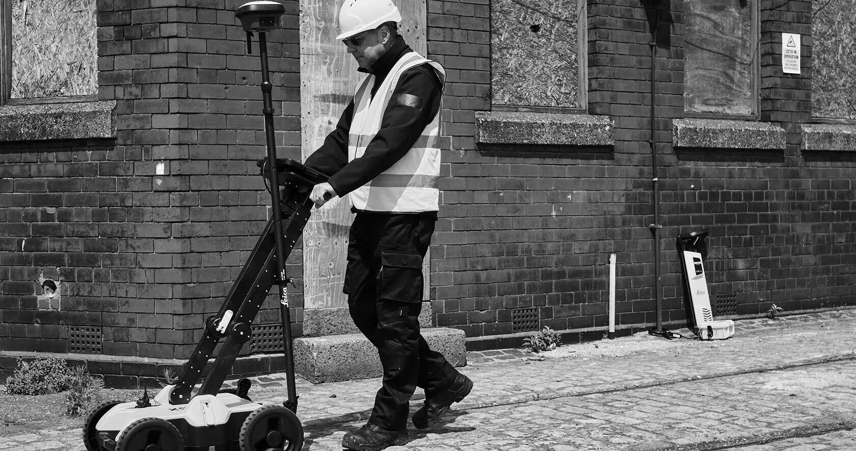
Advanced Utility Detection Techniques
Our PAS 128 surveys incorporate multiple cutting-edge detection techniques, including ground-penetrating radar (GPR), electromagnetic location (EML) and topographic mapping. These advanced tools allow us to conduct subsurface utility mapping, even in the most challenging and complex environments.
Comprehensive Reporting
We deliver clear, accurate and comprehensive reports to help you make confident and informed decisions. Our survey outputs include detailed utility mapping, risk assessments and GIS-compatible datasets, giving you seamless integration with your wider project planning process.
Why Choose Castle Surveys?
Clients choose Castle Surveys for our utility detection services for three main reasons:
Expertise in Utility Mapping
We have extensive experience in delivering PAS 128 compliant surveys across a wide range of projects, from urban developments to large-scale infrastructure projects. Combining the latest technology with industry best practices and years of experience, we have a proven track record for helping clients avoid unforeseen obstacles and costly errors.
Commitment to Compliance
We adhere strictly to PAS 128 standards, ensuring that all of our underground utility surveys meet the highest levels of reliability and accuracy. By following the latest industry guidelines, we safeguard your projects from potential delays, legal complications and utility strikes, giving you confidence in your site data.
Client-Focused Solutions
Our priority at Castle Surveys is to create a utility mapping solution that’s tailored to your exact needs. We work closely with each client to provide customised, clear and actionable insights to keep your project running smoothly.
Get Started with PAS 128 Surveys
Looking to book in a PAS 128 survey? We’re here to help!
Schedule a Consultation
Get in touch with Castle Surveys for PAS 128 surveys—our team is ready to discuss your project requirements and recommend the most effective survey approach. Find out more about Castle Surveys here.
Explore Related Services
In addition to PAS 128 surveys, Castle Surveys offers a wide range of other services to support your project:
- Utility Mapping Services: In-depth insights into underground infrastructure. Explore our utility mapping services.
- Topographic Land Surveys: Detailed surface mapping for comprehensive site planning. Discover our topographic land surveys.
- Boundary Surveys: Clearly define your property lines and prevent disputes. Learn more about our boundary surveys.