The Difference Between CCTV Drain Surveys and Utility Mapping
September 25, 2025 12:19 pmWhen it comes to digging, building or planning anything that involves the ground, knowing what’s below the surface is just as important as what’s above it. Two surveys that often crop up in conversations about infrastructure and construction are CCTV drain surveys and utility mapping. They get confused all the time, but they’re actually very different. One tells you what condition your drains are in, the other shows you where utilities are located. Put together, they save you hassle, money and more than a few grey hairs.
At Castle Surveys, we’re often asked which survey people really need. The honest answer? It depends. Sometimes a CCTV drain survey report is the right tool. Other times, utility mapping is the essential step. And quite often, you’ll want both. Let’s break it down.
CCTV Drain Surveys
Imagine you’ve got a drainage system that’s acting up. Maybe it’s backing up, maybe there’s a nasty smell, or maybe you just want peace of mind before buying a property. That’s where a CCTV drain survey is worth its weight.
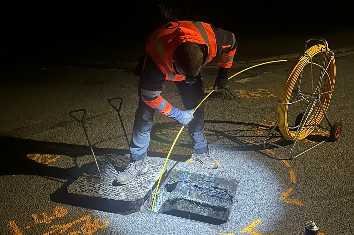
We push a high-resolution camera through the pipes and capture footage of what’s really going on inside. It’s a simple idea, but it works brilliantly. Instead of guessing, you get clear evidence.
A CCTV drain survey can highlight:
- Structural damage, such as cracks, collapsed sections or fractures
- Blockages caused by grease, debris or foreign objects
- Tree roots forcing their way through joints, slowly damaging the pipework
- Pipe alignment, wear and tear, and potential weak points in the system
- Quality checks on new drains, especially where adoption by water authorities is required
The end result isn’t just a video. You’ll get a full cctv drain survey report with images of the issues, professional defect codes, and recommendations on what to do next. I’ve seen these reports save clients thousands, simply by picking up hidden problems before they became serious.

What is Utility Mapping?
Now, utility mapping is a different story. Instead of peering inside pipes, we’re mapping everything hidden beneath the ground, across a site. Think of it as giving you X-ray vision of sorts.
Using tools like electromagnetic locators and ground penetrating radar, we can trace buried services including electricity and telecoms cables, water and gas mains, and much more. Surveys are carried out to PAS 128 standards, meaning you’ll have data you can actually rely on.
A good utility map can show:
- Depth and route of live services
- The difference between metallic and non-metallic utilities
- Colour-coded CAD drawings so you can see everything at a glance
- Service classifications, so you know just how accurate the results are
It’s worth saying here, if your question is “what is utility mapping?” the short answer is simple, it’s a way to know where it’s safe to dig and where it’s not.

When Should You Use Each?
Here’s where things often get muddled. A cctv survey for drains and a utility mapping survey serve very different purposes.
You’d typically need a CCTV drain survey when you’re investigating recurring issues, dealing with an insurance claim, or wanting a condition check before purchase or adoption. It’s your go-to when the problem looks and smells like drainage.
On the other hand, utility mapping is an absolute must before you break ground on a construction site. If you’re piling, laying foundations or even just digging test pits, striking a live service can halt a project, endanger workers, and cost eye-watering sums. Utility mapping is about risk reduction and protecting people, as much as protecting budgets.
How Their Outputs Differ
The end results of these surveys couldn’t be more different.
A CCTV drain survey produces hard evidence inside pipes, video footage you can play back, still images and a cctv drain survey report coded with defects and practical advice. Utility mapping delivers annotated drawings, depth measurements, and full asset routes plotted in CAD with different service types identified in clear categories.
So, CCTV tells you about condition, while utility mapping is all about location.
Why You Might Need Both
Here’s a real-world example. Let’s say you’re developing a brownfield site and you’ve commissioned a full utility survey. The map shows a significant drainage run right across your proposed building footprint. Great. You know where it is. But is it fit for purpose, or is it riddled with cracks? That’s when a CCTV drain survey becomes invaluable, giving you the missing half of the picture.
And then there are cases where a CCTV survey shows a pipe is defective, but you need precise location and route information to design a replacement or diversion. Again, utility mapping fills that gap. One provides detail from within the pipe, the other shows what’s outside it in relation to everything around it.
![]()
Clearing Up Common Misunderstandings
We come across this a lot. People believe utility mapping tells them about drainage condition. It doesn’t. It’ll show you that a drain is there and where it runs, but it won’t show you cracks, blockages or structural damage. A camera is the only way to get that detail.
Others think CCTV inspections will uncover unknown utilities. Unfortunately, they won’t. A camera can only inspect what it can physically access from a drain entry point. If you don’t know the service is there, CCTV can’t help you find it.
Why Castle Surveys?
You have two options: commission two surveys from different companies and try to knit the data together yourself, or come to a team that handles both under one roof. At Castle Surveys, our clients get the latter.
We’ve built our service on bringing drainage inspection and utility surveying together. That means:
- Qualified surveyors who work across both drainage and subsurface detection
- Reports that are fully compliant with national standards such as PAS 128 and WRC
- CAD deliverables that combine results intelligently instead of in silos
- Rapid turnaround so decision-makers aren’t kept waiting
I’ve also found that when one team manages both, you cut out duplication, save time, and ultimately improve accuracy. It just makes sense.
Wrapping Things Up
CCTV drain surveys and utility mapping are both essential in their own right, but they’re not interchangeable. If you need to know what’s happening inside a drainage system, order a CCTV survey and expect a clear cctv drain survey report with footage and recommendations. If you’re planning excavation and need to know where buried services run, utility mapping is the service to call.
Often, the smartest move is to commission both, giving you clarity on location as well as condition. With both sets of data in hand, your project planning becomes safer, smoother and far more cost-effective.
Need accurate underground data? Get in touch with Castle Surveys. We’ll make sure you have all the information you need, exactly when you need it.
This post was written by Paul Jackson
Comments are closed here.