
Regulatory, Safety & Permissions for Mobile Mapping in Urban Areas
February 20, 2026 8:50 amMobile mapping in busy urban areas is about far more than clever technology, and it lives or dies on how well you manage regulations, safety, and permissions. Every project sits under a web of mobile mapping regulations, from GDPR and data protection through to on street safety and local authority approvals, and getting these right is what keeps your team, the public, and your client protected. When it is done well, mobile mapping becomes a powerful, low friction way to capture city data at scale, without creating headaches for compliance officers or project managers further down the line.
What follows is a practical, human focused look at GDPR and mobile mapping, mobile mapping safety, and urban mobile mapping permissions, written for the people who actually have to sign off the risk assessments and explain the approach to clients and local authorities.
Why regulations matter in urban mobile mapping
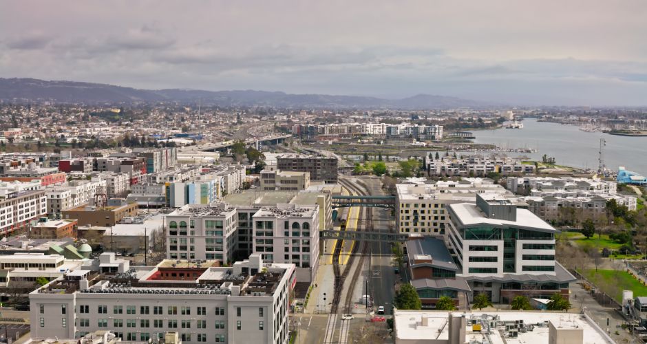
If you have ever driven a mobile mapping rig through a city centre, you will know how exposed it can feel. People look, they sometimes ask questions, and every street you pass along is full of faces, vehicle number plates, shopfronts, and private entrances. All of that is potential personal data, wrapped up in high resolution imagery and point clouds, and regulators take a clear interest in how it is captured and used.
In simple terms, urban mobile mapping sits at the intersection of three quite sensitive areas, privacy, public safety, and public trust.
- Privacy, because your cameras and scanners do not just see the kerb line and façades, they catch people going about everyday life, whether they like it or not.
- Public safety, because you are operating vehicles and equipment in live traffic, near cyclists, and through pedestrian heavy streets, often at awkward times of day.
- Public trust, because councils, utilities, and transport bodies need to be confident they can stand behind the methods you use if anyone questions them.
When mobile mapping regulations are taken seriously, they give you structure and cover. They help you show a regulator, a local authority, or a client that you have thought through the privacy impact, done your safety homework, and followed a clear permission route. When they are ignored, that is when projects get stopped on site, data gets deleted, or in the worst cases, complaints and investigations follow.
GDPR and data privacy in mobile mapping
GDPR can seem intimidating, but in the context of mobile mapping in urban environments, the core question is surprisingly straightforward, are you capturing information that can identify a person, directly or indirectly. With street level imagery, the answer is almost always yes, at least at the raw data stage.
Modern mobile mapping systems collect a mix of data that attracts GDPR attention,
- 360 degree or panoramic imagery of streets and pavements.
- Still images from auxiliary cameras.
- LiDAR or other point cloud data tied to precise coordinates and timestamps.
- GNSS and IMU data linking it all to time and place.
On their own, a few pixels of a person in the distance might not seem like much. In context, however, a recognisable face, a readable number plate, a house number above a door, all linked to a date and location, clearly fall into GDPR territory. That is why regulators and data protection specialists treat mobile mapping imagery as personal data until it has been properly anonymised or removed.
Personal data in street level surveys
Walk down a typical UK high street and imagine it through your system’s cameras. You will almost certainly pick up,
- Faces and bodies of pedestrians and cyclists.
- Vehicle number plates and company branding on vans or lorries.
- Shop signs, flat numbers, intercom panels, and sometimes even people inside windows.
Legally, all of these are relevant because they can either directly identify someone, or act as pieces of a bigger puzzle when combined with other information. For example, a clear image of a front door with a nameplate, captured at a specific time, can be sensitive if mishandled or publicly shared.
That is where automated anonymisation comes in. Many mobile mapping workflows now build in automatic blurring of faces and plates before imagery leaves the secure environment, often using specialist tools designed for large photo collections. Done properly, this can take the data out of GDPR scope once the identifiable elements have been removed, while still leaving highly usable context for engineering, planning, and GIS.
The trick is not to rely on manual checks alone. At city scale, manual blurring is slow, inconsistent, and error prone. Automated tools give you a defensible baseline which can then be spot checked and refined where needed, and that balance tends to satisfy both clients and data protection officers.

Data controllers, processors, and consent
One of the most important GDPR questions to settle early on a project is quite a simple one, who is the data controller.
- The controller decides why the data is being captured and how it will be used.
- The processor handles data on behalf of the controller, following their instructions.
In many urban infrastructure and highways schemes, the client, such as a council, utility, or transport body, will be the controller, and the survey firm will act as the processor. In other cases, particularly where the survey company is collecting data speculatively or for multiple future uses, the survey firm itself may be the controller for some of the processing.
Getting this clear is not just a paperwork exercise. It determines who is responsible for,
- Choosing the lawful basis for processing, such as public task, legitimate interests, or in some rare cases, consent.
- Carrying out a Data Protection Impact Assessment when large scale imaging is involved.
- Defining retention periods and deciding when raw imagery must be deleted or anonymised.
You will notice that consent is not at the top of that list. For most mobile mapping projects in public streets, individual consent is simply not practical. Imagine trying to obtain written consent from everyone in a city centre on a Tuesday lunchtime. Instead, projects often rely on legitimate interests or public task, supported by clear signage, privacy notices, and strong anonymisation steps to minimise any intrusion.
That combination, a justified purpose, a proportionate method, and hard technical measures to strip out identifiable detail as early as possible, is what tends to make GDPR and mobile mapping workable in the real world.
Data protection in urban survey workflows
Beyond roles and lawful basis, mobile mapping teams need to show that data protection is built into the process, not bolted on at the end. In practice, that usually involves,
- Keeping raw, identifiable imagery on secure, access controlled systems, often with encryption at rest and in transit.
- Limiting who can see unblurred images, typically to a small processing team with appropriate training.
- Applying anonymisation or redaction before wider project teams or third parties access the data.
- Documenting retention rules so that raw data is retained only for as long as genuinely needed, for example, to process quality or respond to technical queries, then securely deleted.
Where data needs to move across borders, such as to cloud processing platforms whose data centres sit outside the UK or EEA, the controller must also check that suitable transfer safeguards are in place. Some clients, particularly public sector bodies and police forces, now prefer or insist on UK based processing so they can avoid some of those cross border questions altogether.
Safety considerations in city based mapping
Privacy gets a lot of attention, but anyone who has tried to drive a survey vehicle through a cramped city back street knows that safety is every bit as important. It is easy to assume that mobile mapping is inherently safer than traditional methods because staff are inside a vehicle rather than standing in the carriageway, and while there is truth in that, it is only part of the picture.
You are still putting a vehicle, loaded with unfamiliar equipment, into sometimes complex traffic environments. You may be working around buses, taxis, cyclists, pedestrians glued to their phones, and deliveries parked in awkward spots, all while trying to keep to a planned route and hit data quality targets. That is why mobile mapping safety needs to be thought through just as carefully as for any other highways or street works activity.
Vehicle operations in pedestrian zones
Things get particularly interesting when the route takes you through pedestrianised streets, shared spaces, or town centres with restricted access. The kit may be legal to drive through, but without the right controls, it can look and feel intrusive.
A sensible approach usually includes,
- Clear vehicle branding so people can see that this is a survey, not a mystery van with cameras on the roof.
- High visibility markings and lights so the vehicle is obvious at a distance.
- Additional signage inside windows explaining the activity and pointing to a website or QR code for more information.
On tighter or busier sites, having a trained banksman walking ahead or behind at walking pace can make a big difference, especially where visibility is limited or where you may need to reverse. Some teams also schedule passes through pedestrian areas very early in the morning, before most shops open, to reduce interaction with the public.
The other piece of the puzzle is speed. Although mobile mapping systems can capture data at normal road speeds, that does not mean it is always appropriate to do so in dense, mixed use environments. Slowing down in high risk stretches gives drivers more time to react and reduces the severity of any incident that might occur.
Equipment and public risk management
Then there is the hardware. A modern mobile mapping rig may include a LiDAR scanner, GNSS antennas, an inertial measurement unit, often several cameras, and the mounting system that ties it all to the vehicle. All of that sits above or around the vehicle body, and if anything works loose, it becomes a very real hazard.
Most professional survey teams therefore incorporate equipment checks into their daily routines, including,
- Visual inspection of all mounts, clamps, and brackets before leaving the yard.
- Checking for movement or abnormal vibration after hitting rough surfaces.
- Regular maintenance and inspection records for the rig and sensors.
Another subtle but important point, avoid protruding edges at head height. It can be tempting to mount additional antennas or cameras wherever they fit, but anything that extends beyond the vehicle footprint into the path of a cyclist or pedestrian is an unnecessary risk.
Finally, remember that some sensors, particularly laser devices, have their own safety classifications. Ensuring that your LiDAR units are operated within their specified limits, and that beam paths do not create avoidable eye safety risks at close quarters, is part of running a responsible urban survey operation.
All of this should be wrapped into method statements and risk assessments that drivers, operators, and banksmen actually understand and use, not just documents that live in a folder to satisfy a pre qualification questionnaire. When crews feel ownership of the process, they tend to spot issues earlier and feed back sensible improvements over time.
Permissions and approvals required
Once privacy and safety are under control, attention turns to urban mobile mapping permissions. This is where planning ahead makes life dramatically easier. Turning up in a marked vehicle with visible cameras, without anyone in authority knowing you are coming, is rarely a recipe for a relaxed day on site.
Urban streets are busy spaces with lots of interested parties,
- Local authorities responsible for highways and planning.
- Transport bodies overseeing bus routes, trams, or underground systems.
- Police and security services keeping an eye on sensitive sites.
- Event organisers, business improvement districts, and others managing town centre activity.
Working out who needs to be told, who needs to give permission, and who simply appreciates a courtesy note is a big part of a smooth deployment.
Working with local authorities
For most city based surveys, the starting point is the local highway authority or council. Even if you do not need road closures or traffic management, giving them sight of the plans helps avoid awkward questions if members of the public call in.
Where you do need more intrusive measures, such as,
- Temporary lane closures or stop and go control.
- Suspension of parking bays to keep the route clear.
- Working in bus lanes, clearways, or red routes.
then formal permits come into play. These might sit within existing street works or traffic order frameworks, depending on how the authority is structured, but the principle is the same, share your routes, timings, vehicle types, and risk controls, and secure approval before you arrive.
Transport authorities and police may also appreciate a heads up where routes pass near critical infrastructure, major junctions, or transport hubs. From their point of view, a slow moving vehicle with multiple cameras can look suspicious if they have not been briefed, so a simple email with registrations, contact details, and an outline of the work can prevent misunderstandings.
Project specific considerations
Some locations come with extra complication layered on top. It is worth building these checks into your standard planning process so they become habit.
- Event days
City centres and stadium districts often change character completely on match days, parades, or festivals. Temporary traffic orders, barriers, and security measures can make planned routes impossible, so cross checking with event calendars is essential. - School zones
Surveying past schools at pick up and drop off times is rarely a good idea, both from a safety and perception perspective. Parents can be understandably sensitive about vehicles with cameras near entrances, so scheduling those stretches of road outside those windows can save difficult conversations. - Protected and security sensitive sites
Government buildings, utilities, ports, defence sites, and some industrial facilities can have restrictions or expectations around imaging. Sometimes signage makes this clear, sometimes it does not. When routes pass close by, it is worth asking the client or authority contact whether additional permissions are needed or whether certain angles or areas should be avoided altogether.
Environmental and clean air policies also play a growing role. Low emission zones and congestion charging areas can affect vehicle choice or add cost if you are running older survey vans, so folding those constraints into your planning helps keep budgets and timings under control.
Across all of these, the common thread is that a little planning upfront saves a lot of explanation later. A clear plan, shared early with the right people, tends to be welcomed rather than resisted, particularly when you can show that privacy and safety are already covered.
Castle Surveys’ commitment to responsible mobile mapping
Clients naturally want confidence that their survey partner understands not just the technology, but the regulatory and safety environment that sits around it. That is where a structured, transparent approach really helps.
Firms such as Castle Surveys build GDPR and data protection into their mobile mapping workflows from the very start, not just when a client mentions it. That usually means,
- Treating raw imagery as sensitive and limiting access to trained staff.
- Using proven anonymisation tools to blur faces and number plates before data is shared.
- Agreeing controller and processor roles with clients and supporting them with DPIA inputs where needed.
On the safety side, experienced urban survey teams understand that every city has its own character. Narrow market towns, dense city centres, and strategic ring roads each carry different risks and stakeholder expectations. Having drivers and operators who are used to reading the road, adapting on the day, and feeding back lessons into future plans is just as important as the equipment on the roof.
Then there is communication. Keeping clients, councils, and other stakeholders in the loop about routes, timings, and methods helps head off concerns and demonstrates respect for the environments being surveyed. When people feel informed rather than surprised, they are much more likely to support the work and see the value in the datasets that come out of it.
If your role involves planning or signing off urban mobile mapping projects, you will know that the technical capability is only half the story. The other half is the confidence that the work is being done safely, legally, and in a way that respects the public spaces you are operating in. That is exactly where a clear focus on mobile mapping regulations, mobile mapping safety, GDPR and mobile mapping, and urban mobile mapping permissions pays off for everyone involved.
Need to be certain your next city based survey ticks all the right boxes, from GDPR compliance to on street safety and local authority approvals, you can speak with Castle Surveys about mobile mapping solutions that are designed around regulatory confidence as well as high quality data.
This post was written by Paul Jackson
Comments are closed here.