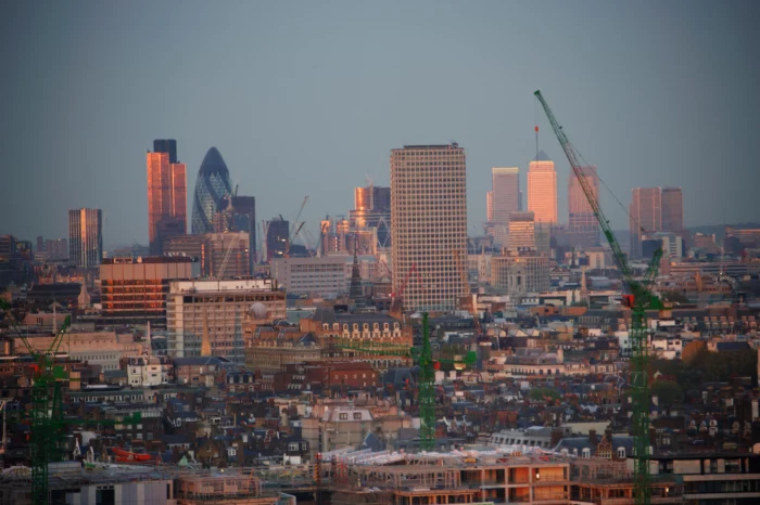
London’s underground network is one of the most complex and congested anywhere in the world. Beneath its roads and pavements lie hundreds of years of hidden infrastructure: ancient brick sewers, modern fibre‑optic cabling, live gas mains, electric ducts, and abandoned tunnels. For any contractor or designer working in the capital, knowing what lies beneath is non‑negotiable.
Castle Surveys Ltd provides professional GPR survey services in London designed to make that unseen world visible. From our centrally located Soho office on Poland Street, our survey teams deliver rapid, PAS 128 compliant utility mapping across all London boroughs. We support principal contractors, architects, and engineers managing construction, refurbishment, or excavation projects where safety and accuracy are critical.
Whether you’re overseeing a basement extension in Kensington, a highways upgrade in Croydon, or new utility connections in Canary Wharf, our Ground Penetrating Radar (GPR) surveys deliver the reliable data you need to proceed safely, reduce risk, and plan with confidence.
Enquiry Form


Edit: in the end it was 3 weeks so not terrible, but still longer than we'd expected since all other surveys turned around in 1 week


Thanks


Great service and detailed drawings
Thanks

They provided an extremely detailed survey of a large property. The price was a fraction compared to their competition.
The team was a pleasure to deal with and would definitely use Castle Surveys again.
Many thanks

Deliverables were produced and shared with other parties that were also very happy with the standard of work.
I would highly recommend to others.

We definitely recommend them
Ben

Would highly recommend.


Syb

Thank you Paul for an excellent service.
Navigating London’s Complex Underground Infrastructure
Anyone who’s built or managed projects in Greater London knows that no two streets share the same subsurface history. Each layer of the city’s infrastructure has been added, adapted, and replaced countless times. That makes digging or piling without verified utility data not just risky, but potentially catastrophic.
London’s below‑ground landscape is an intricate web of overlapping systems:
- Nineteenth-century brick sewers installed by Bazalgette still running under central streets
- High-voltage electricity cables supplying critical infrastructure
- Sensitive fibre-optic networks feeding global data centres in Docklands
- Gas mains and water assets crossing every major junction in the city
- Redundant iron pipes, ducts, and voids left from decades-old demolition
In such dense conditions, even a small mistake can lead to utility strikes, service outages, or dangerous leaks. The result? Costly project delays, HSE investigations, insurance claims, and reputational damage.
That’s why forward‑thinking engineers and site managers across London choose Castle Surveys’ underground utility mapping services. We combine thorough risk management, local logistical know‑how, and cutting‑edge scanning technology to deliver the clear, actionable information that makes safe excavation practices possible.
How Our Ground Penetrating Radar (GPR) Surveys Work
GPR is one of the most effective tools available for mapping underground utilities accurately and safely, particularly in urban settings like central London, where excavation space is limited and disruption must be minimised. But how does it actually work?
The Science Behind GPR
Using a surface-mounted antenna, Ground Penetrating Radar sends high-frequency electromagnetic pulses into the ground. When these radar waves hit things that are buried or changes in the density of the material, some of the signal bounces back to the receiver. Then, advanced processing software turns those reflections into a visual cross-section that shows the depth and location of underground features.
Because GPR detects both metallic and non-metallic materials, it identifies far more than traditional cable detection alone. Clay pipes, plastic conduits, voids, and even buried foundations can all be visualised in the radar data.
The Non-Intrusive Advantage
The most important thing is that GPR doesn’t hurt anything. You don’t need to core, dig, or remove the surface, so it’s great for busy or sensitive areas like Westminster, the West End, or transportation hubs. Surveys can often be done outside of busy times, so businesses and the public can keep going as usual.
Combined GPR and EML Tracing
For the most reliable results, Castle Surveys combines GPR with Electromagnetic Location (EML) tracing. This dual-method approach allows us to detect and verify both conductive and non-conductive utilities, improving coverage and classification confidence. Metallic assets (such as power cables and metal pipes) are traced via EML, while non-metallic and deeper targets are captured through radar scanning.
The merged dataset provides a comprehensive 3D understanding of the site’s subsurface conditions, critical for accurate design and safe excavation.
PAS 128 Compliant Surveys for Safe Excavation
In the UK, PAS 128 is the nationally recognised specification for underground utility detection, verification, and location. Compliance with this standard is considered best practice, and, for many commercial and local authority clients, it’s a contractual requirement.
At Castle Surveys, every GPR and utility survey we deliver in London aligns with PAS 128:2022 methodology. That means your site data is traceable, quality‑controlled, and defensible should an audit or investigation occur.
Our deliverables specify:
- Survey Type (e.g. Type B – Detection or Type A – Verification)
- Quality Level (e.g. QL-A through to QL-D)
- Methodology and equipment used
- Positional accuracy ranges and confidence scores
- Utility line attributes (depth, material, and orientation)
Following PAS 128 ensures your survey isn’t just a technical exercise, it’s a compliant and safety‑assured record supporting safe excavation practices and meeting all Health & Safety Executive (HSE) recommendations.
For clients requiring enhanced verification, we can also coordinate vacuum excavation or trial holes to expose and record utilities visually, upgrading detected services to Quality Level A.
Comprehensive Subsurface Services in Greater London
London projects often require much more than simply locating buried cables. Our GPR data integrates seamlessly with a range of additional services, providing a full subsurface picture for construction planning, design coordination, and structural assessment.
Pre-Construction Planning
Accurate below-ground information is vital for architects and designers. We integrate verified utility data into topographical and Revit models so you can identify potential clashes before they become costly site obstacles. Linking this data into BIM platforms allows smoother coordination across design and construction teams.
Geotechnical Preparation
Our borehole clearance surveys make sure that the proposed locations are clear of live utilities or other obstacles before we do geotechnical drilling, environmental sampling, or piling work. This check keeps people safe, stops service strikes, and makes sure that CDM rules are followed.
Void and Anomaly Detection
Certain areas of London, particularly in the City, Westminster, and the older boroughs, hide undocumented basements, air-raid shelters, or obsolete foundations. Using GPR, we can detect voids, buried cellars, or tunnels before excavation begins, reducing structural risk and informing design decisions.
Post-Construction Documentation
Once works are complete, we can rescan to produce accurate as-built records, updating your asset register and supporting long-term maintenance programmes.
Every dataset we produce is geo-referenced, allowing easy integration with your CAD, GIS, or BIM platforms for ongoing asset management.
PAS 128 in Practice: What It Means for London Sites
PAS 128 defines how utility surveys must be undertaken, ensuring a consistent, measurable quality level across the profession. In essence, it replaces assumptions with verified data.
In London, where projects are routinely undertaken near critical national infrastructure, compliance protects both contractors and the public. It requires surveyors to:
- Use multiple complementary detection methods (GPR, EML, and where necessary, visual confirmation)
- Accurately record survey positioning within tight tolerances
- Provide clear metadata and confidence coding for every identified utility
- Document equipment calibration and environmental conditions
At Castle Surveys Ltd, we take this further by implementing additional quality checks and in-house training to ensure our London operations consistently exceed PAS 128 expectations. Our utility mapping technicians undertake continuous development in interpreting radargrams within complex, interference-heavy environments such as the London Underground vicinity or high-density electrical corridors.
Simply put, we don’t leave accuracy to chance.
If you’d like to better understand how PAS 128 safeguards projects like yours, our resource on safe excavation practices breaks down everything HSE and clients expect from a compliant utility survey.
Why Choose Castle Surveys for Your London Project?
London demands precision, flexibility, and local expertise, and that’s exactly what Castle Surveys delivers.
Local Presence and Rapid Mobilisation
Our London office, based at 54 Poland Street in Soho, places our surveyors at the heart of the capital. We can mobilise rapidly to anywhere across Greater London, from Richmond to Romford, and begin work within hours if required. Whether your site needs early-morning surveys to avoid congestion or weekend access to minimise disruption, we schedule to suit your programme.
Experience with Urban Logistics
It’s not just about the data when it comes to mapping utilities in London; it’s also about figuring out how to deal with logistical problems. We take care of every step, from getting parking spaces and managing traffic temporarily to working with local borough councils. Our teams are fully trained in urban surveying safety and have the right permits and accreditations to work on TfL and local authority networks.
Cutting-Edge Equipment and Data Integration
We use next-generation radar systems that can get high-resolution data through concrete, asphalt, and the many different types of ground that make up London’s multi-layered subsurface. This data goes right into CAD or GIS systems, making it easy to see every line, duct, or void that has been found.
Our expertise doesn’t stop at GPR, though. Because we’re a full-service geomatics provider, we can combine radar results with underground utility mapping, topographic surveys, and borehole clearance surveys for a complete site overview.
Full-Service Capability
From surveying services in London that support initial feasibility assessments to modelling-ready data for large engineering schemes, our end-to-end offering means one point of accountability and one standard of accuracy across all deliverables.
Proven Experience Across London Boroughs
Recent examples include:
- A multi-phase GPR utility survey in Southwark for a new mixed-use development, integrating PAS 128 QL-B data into the client’s Revit model.
- High-density radar scanning at Paddington Station to identify disused electric conduits under Network Rail property.
- Borehole clearance and void detection along Shoreditch High Street ahead of basement renovations in a historic Grade II building.
Every project is carried out by experienced utility surveyors, fully insured and certified to industry standards.
The Risks of Working Without Accurate Utility Data
Too often, excavation in London begins without a current utility survey. Teams rely on outdated record drawings or partial asset plans, which rarely reflect what’s actually beneath the surface.
The consequences can be serious: service strikes, costly project stand‑downs, or personal injury. According to HSE data, utility strikes account for numerous incidents each year, and the financial and reputational damage can be severe.
A professional GPR survey London ensures that never happens. By revealing both known and unknown underground features, Castle Surveys’ reports give you tangible security, protecting your workforce, your programme, and your bottom line.
Integrating GPR Data With BIM and Design Workflows
Today’s construction projects demand far more than conventional 2D drawings. Accurate spatial data supports digital design coordination, 3D modelling, and asset management throughout a project’s lifecycle.
Castle Surveys delivers utility data in multiple formats, compatible with CAD, GIS, and BIM platforms. Our survey outputs can feed directly into federated models used for design coordination or clash detection, giving project teams a holistic understanding of surface and subsurface conditions in one unified environment.
This integration of Ground Penetrating Radar (GPR) data within Building Information Modelling helps reduce errors, enhances collaboration among stakeholders, and improves communication with clients and planners, an essential advantage in London’s high‑value, high‑pressure construction sector.
Your Trusted Local Partner in GPR and Utility Mapping
Choosing the right survey partner means finding a team that understands both technical accuracy and the reality of working in London. Castle Surveys has spent over a decade delivering precision data to some of the UK’s largest contractors, consultants, and developers.
We combine nationwide resources with genuine local expertise, experienced London surveyors, fast response times, and on‑the‑ground knowledge of the city’s logistical challenges. When time, accuracy, and safety matter, you can rely on Castle Surveys to deliver.
Request a Fast Quote for Your London GPR Survey
Need a GPR survey in London quickly? Our responsive Soho‑based team is ready to help. Simply call 020 3728 2884 or send your project details, postcode, site type, and required scope, through our online form, and we’ll provide a transparent, same‑day quotation.
Whether you’re mapping utilities ahead of a basement excavation, planning roadworks, or preparing for structural monitoring, Castle Surveys offers the speed, accuracy, and compliance your project demands.
For complete peace of mind, choose the experts in Ground Penetrating Radar (GPR) and PAS 128 compliant underground utility mapping, right here in London.