
How to Carry Out Hydrographic Surveys
August 27, 2025 12:36 pmIf you have ever looked over a river or harbour and wondered how anyone knows what is below the water, you are not alone. Whether you are planning construction near water or simply curious about nautical charts, learning about hydrographic surveys combines technology, careful planning, and practical fieldwork, all aimed at mapping the underwater environment.
Typically, the process involves setting up accurate positioning and calibrating all technology, system alignment and validation checks, navigating along planned lines or grids to avoid gaps in data, collecting bathymetric and sometimes topographic data during transit, and validating incoming data in real time so any issues can be resolved immediately. A systematic approach is essential for producing reliable results.
Data Processing and Analysis
Once collected, raw data must be processed. This includes cleaning up data, removing outliers, correcting for tides and vessel motion, and organising the results for analysis. The processed data can then be used to create digital terrain models that visualise the underwater landscape in three dimensions, contour plots that show features such as sandbars and pools, and deliverables integrated into CAD or GIS software for use in engineering and planning. Strict quality assurance is observed to ensure all delivered reports are accurate and reliable.
Reporting and Applications
Clients receive detailed charts, 3D models, and georeferenced maps from hydrographic surveys. These deliverables support practical decisions on dredging, construction, compliance, and environmental monitoring. For example, survey data may identify buried obstructions before new works begin, preventing costly delays.
Looking for Hydrographic Survey Support?
There are many variables to consider, from equipment selection to final reporting, but thorough preparation ensures your project’s success. If you are considering a survey or seeking advice, contact Castle Surveys Ltd. We will deliver accurate, timely, and project-ready hydrographic surveys tailored to your needs. If you would like more information about our services, including guides on topographic surveys, drone surveys, or measured building surveys, please get in touch for further details or view our quality assurance standards.
What is a Hydrographic Survey?
A hydrographic survey maps the features found beneath bodies of water, such as riverbeds, lake bottoms, harbours, and coastal zones. Civil engineers use these surveys for bridge construction, authorities rely on them for dredging plans, and environmental professionals depend on the data for monitoring aquatic habitats and flood risks. These surveys bring clarity to underwater conditions, offering not just depth measurements but details on safe navigation, hidden hazards, compliance requirements, and habitat preservation. The applications are as varied as the waterways themselves.
Planning and Preparation
Thorough planning is essential. Start by checking site conditions like tides, weather, and typical waterway activity, as these can change rapidly, define exactly what needs to be surveyed, including its size, depth, and purpose for the results, and address all safety requirements through risk assessments and by following local regulations. Good preparation helps avoid costly delays later, saving time, resources, and effort.
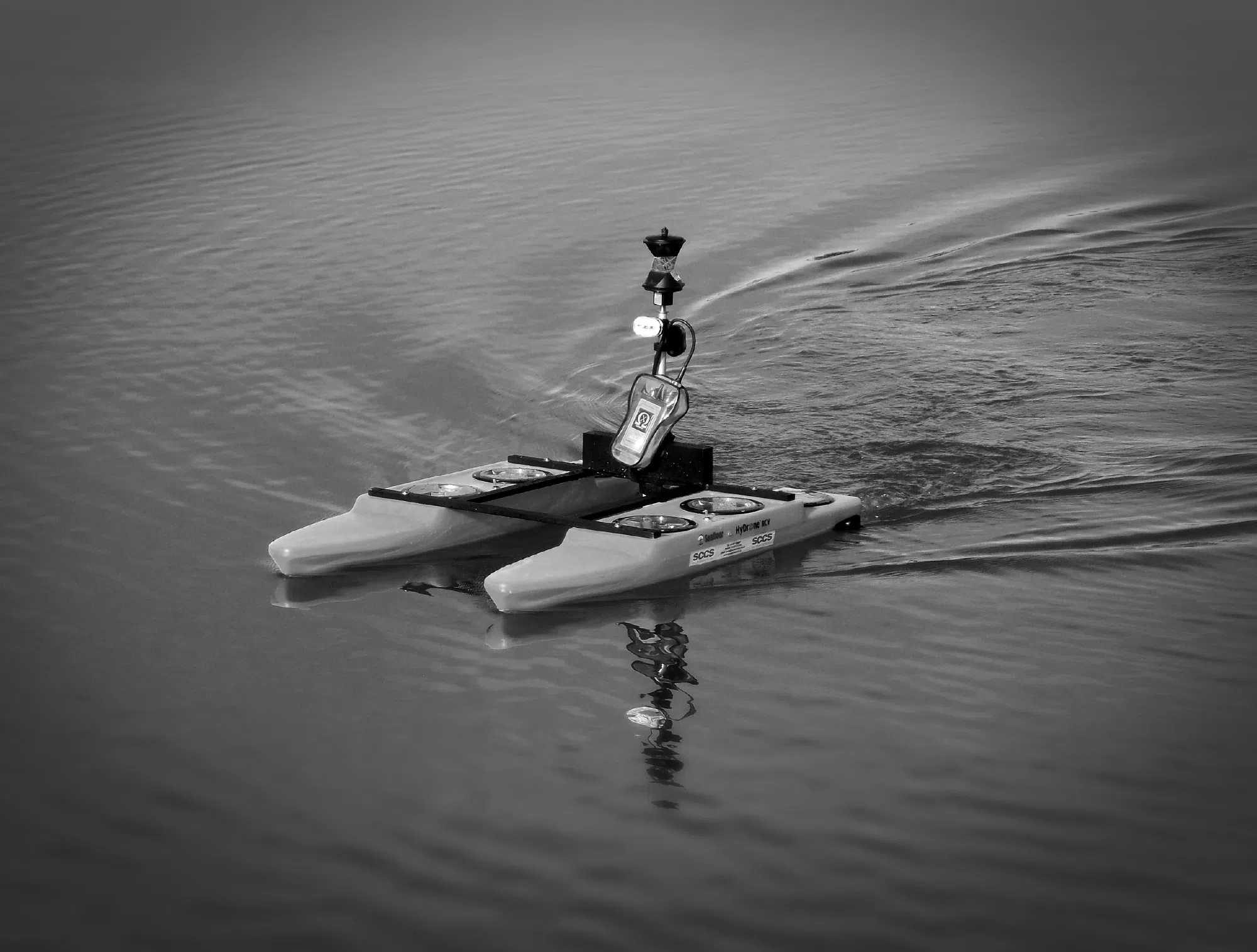
Equipment Used in Hydrographic Surveys
Modern hydrographic surveying is highly technical. Today’s surveys use advanced equipment, including multibeam echo sounders for detailed seabed images, single beam sonar for precise depth readings, GPS and GNSS systems to ensure accurate positioning, and motion sensors and tide gauges to provide reliable measurements in changing conditions. Survey vessels can be traditional boats or, increasingly, unmanned surface vehicles that access hard-to-reach or shallow areas. Selecting the right technology for each survey is critical, and unmanned solutions are particularly effective in challenging or hazardous locations.
Hydrographic surveys bridge the gap between what lies unseen beneath the water and the critical information engineers, developers, and environmental specialists need to move projects forward. By combining precise technology, rigorous planning, and expert analysis, these surveys provide the clarity required to make confident decisions on safety, compliance, and design. With Castle Surveys Ltd, you gain a trusted partner dedicated to delivering accurate, reliable, and actionable results that turn underwater uncertainty into project-ready insights.
This post was written by Paul Jackson
Comments are closed here.