
How Drone Surveys Are Revolutionising Civil Engineering Projects
September 25, 2025 1:54 pmEver wondered how drone surveys are used in engineering, not just for pretty aerial photos but for proper, game-changing results? I’ve seen a lot in the world of surveys, from muddy boots to high-vis jackets, but nothing shook things up quite like drones. Suddenly, collecting vast amounts of data wasn’t a week-long slog—it could happen before you’d finished your second coffee.
The Rise of Drone Technology in Engineering
Let’s be honest, drones used to be the sort of thing you saw on the news or at a hobbyist’s meet. Now though, UAV surveys are popping up on just about every major site in the UK. Why? It’s simple—they make site work safer, faster, and a whole lot more accurate.
I remember working on a project where traditional surveys would’ve meant scaffolding over live traffic. Instead, a drone handled the lot, and we got data that was not only quick, but far more detailed than I’d expected.
Key Benefits of Drone Surveys for Engineering Teams
Speed and Efficiency
It only takes a handful of flights for a drone to capture thousands of data points—even across muddy fields, quarries, or sprawling highways. What’s brilliant is how much time you save. No more waiting around for access, no more climbing up embankments with gear. Site teams can crack on with other jobs, and safety officers breathe a sigh of relief.
Accuracy and Detail
You’ll get crisp, high-res orthophotos and 3D models that slot straight into your CAD or GIS systems. It’s genuinely satisfying seeing ground models and contour maps line up so perfectly with the reality. Those little surprises—like an undetected slope or hidden structure—are picked up from the start, not halfway through a job.
I’ve found that when you combine drone data with GNSS or classic total stations, you get results you can really trust—especially on projects where a millimetre really does matter.
Cost and Resource Savings
Drones don’t moan about overtime or need hard hats. With fewer team members out on tricky ground, you cut down risk and expense. On one job, we skipped three weeks of manual work just by flying the site early doors. And if a site changes overnight (think: excavation, heavy weather, or even just unexpected lorry tracks), another drone lap brings everything back up to date.
Safety and Accessibility
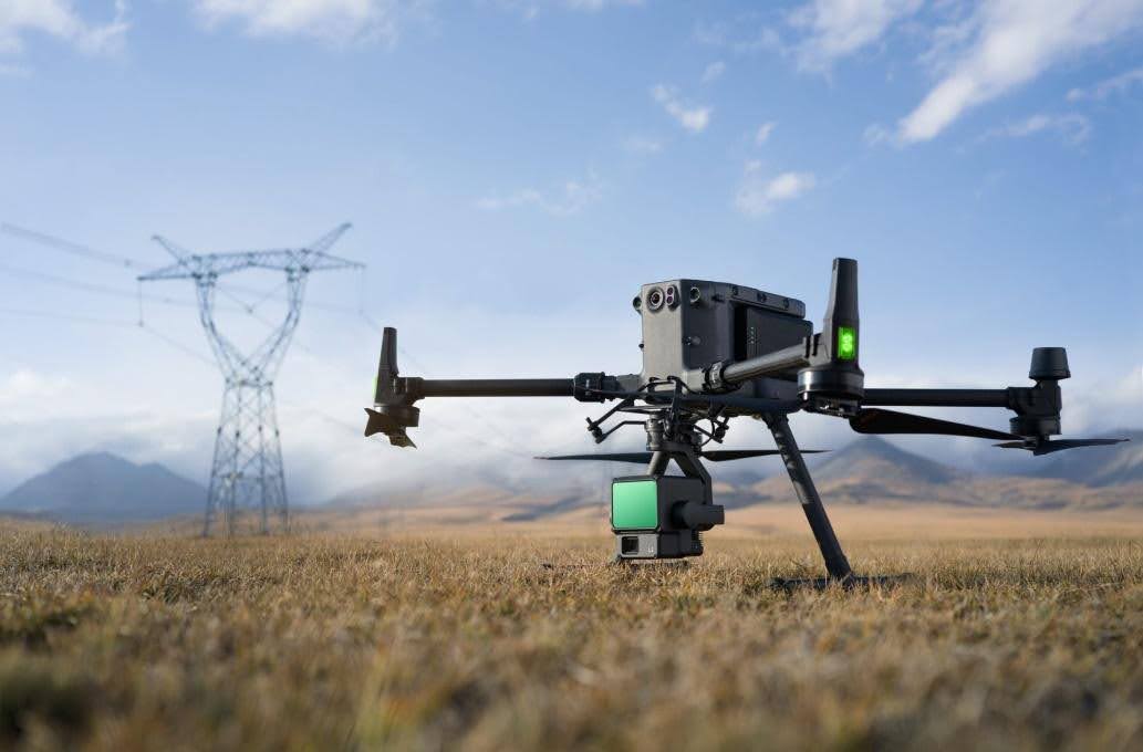
Let’s face it, civil engineering sites aren’t always friendly places. Sheer drops, deep water, busy roads—these are no place to set up a tripod. Drones make inspections quick and, more importantly, keep surveyors out of harm’s way. I’ve watched a drone skim over rooftops or bridges where there’s no safe way to set foot, and thought, “Why did we ever do it the hard way?”
Real-World Engineering Applications of Drone Surveys
Topographic Mapping for Site Design
A decent aerial topographic survey gives you the lay of the land before anyone picks up a shovel. It’s perfect for pre-start planning, cut and fill calculations, drainage layouts—you name it.
Progress Monitoring and Reporting
Who doesn’t want clear, up-to-date progress snaps? Regular drone flights let project managers, clients, and stakeholders see exactly what’s happening week by week. I’ve found it’s also a nifty way to prove to everyone (including the client’s finance team) that work is moving on schedule.
Structural Inspections and Compliance
There’s something deeply satisfying about inspecting a bridge, tower, or high-rise from the comfort of the ground. Drones handle it all, snapping close-ups that often spot issues earlier than a scaffold-and-walk inspection. It’s quick, thorough, and—best of all—doesn’t slow down other work.
Integrating Drone Data with Traditional Surveying
You might wonder if drones mean ditching established survey methods. Not a chance. In fact, the best results come from blending the two. Total stations and GNSS lay down control points, then drone outputs lock in to that framework. This approach guarantees accuracy, keeps regulators happy, and means your data is legally watertight.
At Castle Surveys, we make sure aerial and ground data work hand in glove. We calibrate everything, run cross-checks, and put deliverables into whatever format you or your design team prefer. It’s about giving you information you can act on, not just a stack of files.

Why Work with a Specialist Drone Survey Provider
Not every drone survey is built equal—trust me, the difference shows. You want a provider with:
- Licensed operators who know the CAA rules and can fly wherever your project needs.
- Solid insurance (because surprises do happen).
- Proven know-how with civil engineering sites of every size.
- Flexible options, whether it’s a mega-project needing full-lifecycle monitoring or a single inspection.
- I’ve had clients come back just for the peace of mind, knowing they’re getting usable results that fit straight into their schedules.
Here’s the Takeaway
Wondering how drone surveys are used in engineering? They’re shifting the landscape—quicker checks, safer projects, and sharper decision-making all round. Drones used in civil engineering surveys pick up every grain of truth the naked eye would miss, and make work easier for everyone on-site.
Thinking of giving your next project a modern edge? Fancy seeing what a professional drone survey can do for you? Get in touch with Castle Surveys Ltd. We’ll fly the extra mile (sometimes quite literally) to collect the data that keeps your project ticking over, from start to finish.
Curious how we combine aerial and ground expertise? Take a peek at our Drone Surveys and Topographic Land Surveys, it’s all about getting the best result for your team and your site.
This post was written by Paul Jackson
Comments are closed here.