How 3D Laser Scanning Enhances Survey Accuracy and Efficiency
April 30, 2025 5:43 pmSurveying has come a long way from the days of the tape measure and theodolites. Since the advent of 3D laser scanning, surveyors can acquire exact geospatial data in a fraction of the time. Technology is transforming the industry by enhancing precision, efficiency and reliability in most surveying applications.
We employ 3D laser scanning at Castle Surveys Ltd to deliver precise and detailed surveys to building contractors, project managers, engineers, planners and architects. 3D laser scanning is vital for data precision and project success in topographic land surveys, measured building surveys, PAS128 underground utility surveys and mobile mapping.
What is 3D Laser Scanning?
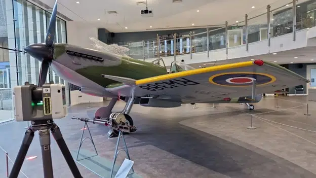
3D laser scanning is a contactless, high-accuracy surveying technique that captures real-world environments in three dimensions. Using Light Detection and Ranging (LiDAR) technology, laser scanners emit millions of laser pulses per second to capture surfaces with millimetre accuracy. The pulses reflect back to the scanner, recording distance, shape and texture to construct a high-accuracy point cloud model.
Key Components of 3D Laser Scanning
- Laser Scanner: Emits laser pulses and measures their return time.
- Point Cloud Data: A dense set of data points describing a physical surface.
- Software Processing: Converts raw data into accurate 3D models and digital twins.
The Role of 3D Laser Scanning in Surveying
1. Unmatched Survey Accuracy
Accuracy is the foundation of any successful survey. Traditional methods rely on manual measurements, increasing human error. 3D laser scanning eliminates these mistakes, achieving millimetre precision. A 2024 study in the International Journal of Surveying and Structural Engineering reported ±2 mm accuracy versus ±10 mm for conventional methods. Such precision is crucial for applications like:
- Topographic land surveys – precise site measurements for design and planning.
- Measured building surveys – detailed interior and exterior data for extensions and refurbishments.
- Construction verification – comparing as-built structures to design models.
For example, Castle Surveys Ltd used 3D laser scanning to verify a newly built building against its BIM model, revealing a deviation of just 3 mm, corrected before further works resumed.
2. Enhanced Efficiency and Speed
Manual surveys can take days, while 3D laser scanning captures millions of points in minutes. Benefits include:
- Quicker data collection – large sites surveyed within hours.
- Reduced field time – minimal disruption to ongoing works.
- Rapid processing – point clouds and 3D models shared quickly.
At Castle Surveys Ltd, we’ve seen scanning times drop by up to 80%, significantly shortening project timescales.
3. Improved Safety Under Hazardous Conditions
Surveying in rugged terrain, congested traffic or unsafe structures poses risks. 3D laser scanning allows remote data capture, keeping surveyors at a safe distance. In a Manchester industrial estate project, our team scanned deteriorating floors without entering hazardous areas.
4. Seamless Integration with Digital Twins & BIM
Digital twins are online replicas of physical assets, enabling virtual analysis before real-world changes. 3D laser scanning feeds accurate data into:
- BIM: Accurate models for design and planning (learn more).
- Facility management – electronic records for maintenance and upgrades.
- Construction verification – identifying as-built discrepancies.
5. Less Rework and Cost Savings
By boosting accuracy and efficiency, 3D laser scanning reduces costly errors. McKinsey research estimates 30% of construction costs stem from rework. Precise measurements from the outset minimise waste and delays, delivering financial benefits like:
- Fewer site visits – reduced travel costs and time.
- Less material waste – correct specifications lower rework.
- Optimised timelines – fewer delays from wrong data.
Applications of 3D Laser Scanning in Surveying
3D laser scanning has broad applications, including:
- Topographic Land Surveys – high-order site models mapping terrain and features.
- Measured Building Surveys – detailed sections, elevations and floor plans.
- Construction Verification – ensuring built works match design intent.
- Mobile Mapping – large-scale data capture for roads and urban projects.
The Future of 3D Laser Scanning in Surveying
Emerging trends will further advance the technology:
- AI-facilitated data processing – faster, automated analysis.
- Drone-based scanning – access to hard-to-reach areas.
- AR integration – real-time visualization for engineers and managers.
These innovations will make surveying cheaper, simpler and more secure, reinforcing 3D laser scanning’s role in modern construction and infrastructure.
Boost Your Surveys with 3D Laser Scanning
Castle Surveys Ltd employs the latest 3D laser scanning technology to provide precise, efficient survey data. From topographic surveys to measured building surveys and mobile mapping, our skilled team sets your project up for success.
Looking for precise and efficient survey solutions? Contact Castle Surveys Ltd today to discuss your project needs or visit our 3D laser scanning services.
This post was written by Paul Jackson
Comments are closed here.