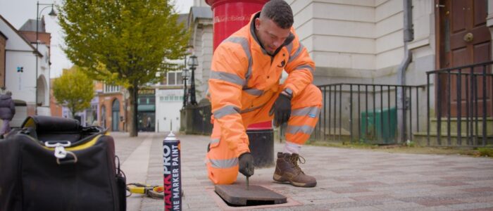
A Guide to PAS128 Underground Utility Surveys for Safe Excavation
April 20, 2025 5:33 pmExcavation work is an integral part of several infrastructure and construction projects. However, excavating without knowledge of underground utilities can result in costly damages, project postponements and significant safety threats. That’s where PAS128 underground utility surveys come into play.
What is a PAS128 Underground Utility Survey?
A PAS128 underground utility survey is an established methodology that enhances safety and efficiency in construction and excavation. Before PAS128, utility surveys varied widely in quality and reliability. The standard ensures consistency by defining transparent methodologies, data quality levels and survey categories.
Survey Levels (QL)
- QL-D (Desktop Survey): Uses existing records from utility providers to get an initial idea of underground services.
- QL-C (Site Reconnaissance): A site walkover to identify surface features indicating buried utilities.
- QL-B (Geophysical Survey): Uses ground-penetrating radar (GPR) and electromagnetic location (EML) methods for accurate utility locating and mapping.
- QL-A (Verification Survey): Exposes utilities physically (e.g., vacuum excavation) to validate precise locations and depths.
The Importance of PAS128 Surveys for Safe Excavation
- Preventing Utility Strikes: Avoid power outages, water leaks or dangerous gas leaks by accurately mapping existing infrastructure.
- Compliance with Health & Safety: PAS128 surveys conform to HSE Guidance HSG47 and the Health and Safety at Work Act 1974.
- Minimising Delays & Costs: Plan excavations without unexpected disruptions, keeping projects on time and within budget.
- Enabling Effective Design & Planning: Architects and engineers use accurate maps to integrate underground services into designs.
- Environmental Safeguarding: Prevent contamination of water lines and soil pollution by avoiding damage to pipelines.
How PAS128 Surveys Are Conducted
At Castle Surveys Ltd, we follow a strict process to ensure precision and trustworthiness:
Step 1: Desktop Study (QL-D)
We collect existing utility records for water, gas, electricity, telecoms and drainage networks. This provides a starting point, though records may be outdated or incomplete.
Step 2: Site Reconnaissance (QL-C)
Our surveyors perform a visual inspection to document manholes, chambers and utility markers, verifying the desktop data on site.
Step 3: Geophysical Survey (QL-B)
Using advanced non-intrusive techniques:
- EML: Detects metal cables and water pipes via transmitter and receiver.
- GPR: Uses radar pulses to identify metallic and non-metallic utilities.
- LiDAR & Digital Twins: Refines and digitises all data.
Step 4: Verification Survey (QL-A)
Trial excavations with vacuum excavation verify depths and positions, ensuring utmost precision.
Step 5: Final Utility Mapping
We produce detailed CAD maps highlighting locations, depths and types. These reports are essential for safe excavation planning.
PAS128 Surveys in Different Sectors
- Construction & Infrastructure: Safe excavation for buildings, roads and rail projects.
- Utilities & Energy: Mapping underground assets for gas, water and electricity networks.
- Transport & Highways: Prevent disruptions before roadworks and rail expansions.
- Property Development: Accurate data for architects and planners.
Why Choose Castle Surveys Ltd?
- Experienced Surveyors: Years of expertise in underground utility mapping.
- Advanced Technology: State-of-the-art GPR, EML, LiDAR and digital twins.
- In-Depth Reports: PAS128-compliant reports with clear utility maps.
- Safety-First Approach: Proactive risk mitigation and compliance.
- Industry Leader: Serving architects, construction firms and engineers UK-wide.

Excavation without a proper survey is a significant risk. Contact us to schedule your PAS128-compliant survey and ensure safe excavation for your next project.
This post was written by Paul Jackson

Comments are closed here.