Floor Plans
Elevations
Sections
Roof Plans
Ceiling Plans
Internal Elevations
Street Scene Elevations
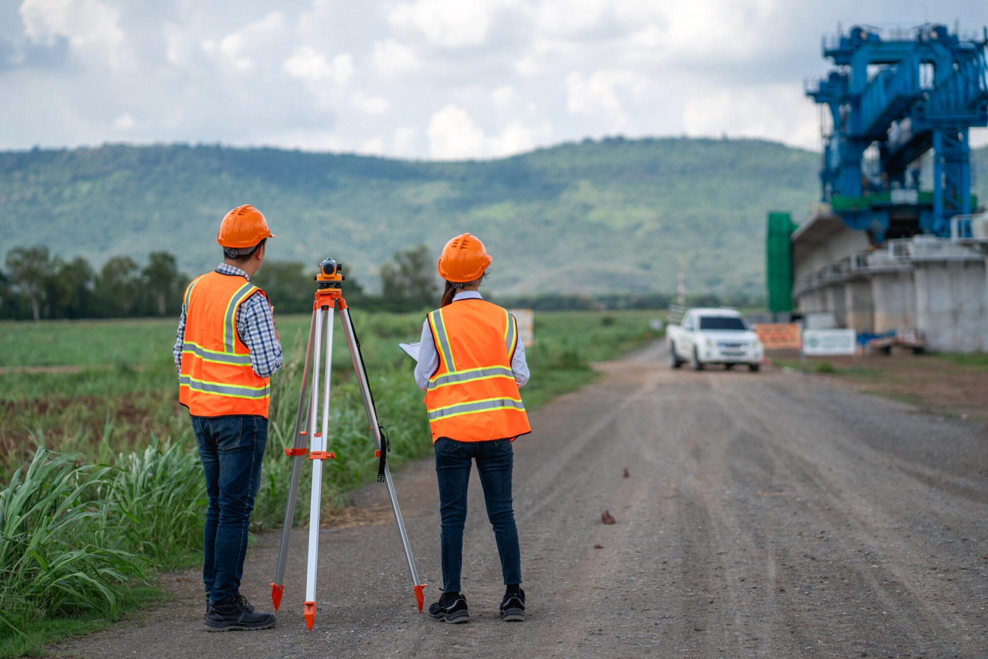
Area Surveys & Reports
Lease Plan Surveys
Heritage Surveys
BIM
Measured building surveys are an accurate representation of the building’s layout, structural elements and architectural features
A typical survey would show all structural features including windows, doors, walls, beams, floor and ceiling heights.
Onto this we can then add fixtures and fittings such as electric points, light switches and fittings, radiators and furniture.
They are used for conversion and renovation projects, spatial management analysis and lease/land registry compliant plans.
At Castle Surveys we are very proud of the high quality and diverse array of floor plans we produce for our wide range of clients.
Some of our previous work comprises of schools, commercial and agricultural buildings, offices, portal framed structures, healthcare centres, listed buildings, domestic dwellings, heritage sites, churches, castles and many more.
We carry out all of our measured building surveys using Leica disto laser measurers coupled with site laptops running MBS Floor Plan software.
The software shows the misclosure on site, in real-time, enabling our surveyors to immediately see where control measurements are needed to meet the accuracy requirements of the project.
A wide variety of measurement methods can be chosen, depending on the particular building being surveyed.
Intelligent data is collected at the same time as the measurements and attached in the form of attributes to allow for detailed analysis back in the office.
In addition, we utilise our Leica total stations internally to traverse through the building, ensuring our surveys are measured to the highest level of accuracy.
External elevations refers to an orthographic projection of the exterior (or sometimes the interior) of faces of a building or structure.
This is a two-dimensional drawing of the building’s façades. As not all buildings are simple rectangular shapes in plan, an elevation drawing is a first angle projection that shows all parts of the building as seen from a particular direction.
Generally, elevations are produced for four directional views for example: north, south, east and west.
These can then be imported into software such as SketchUp and Revit to create complex and accurate 3D models and visualisations.
Castle Surveys captures this data utilising our 3D laser scanners to ensure the best quality deliverables for our clients.
Typical features to be shown on an elevation drawing are:
Castle Surveys can produce detailed cross sections of both measured building and topographic land survey.
A section drawing shows the accurate representation of the structure as if it had been sliced vertically along a known plane.
This plane would be indicated on the measured floor planes as a section line.
For buildings and structures, sections can give a greater understanding of its construction and the relationships between components such as stairs, walls, floor thicknesses, window and door openings.
A roof plan is an accurate representation of the roof. It shows the ridge lines, valleys, slopes, ventilation and more.
A roof plan can be a vital part of the planning stage for any new roof construction, renovation, repair and extension work being performed on an existing roof.
Using traditional survey methods in conjunction with 3D laser scanning and now drones technology and photogrammetry.
Castle Surveys can provide detailed and accurate roof plans for your project.
A reflective ceiling plan (RCP) is a drawing that details the features that are located on the ceiling of a room or space.
Fox example, this type of plan will show the detail of a grid of suspended ceiling tiles, which can then be overlaid onto the measured floor plan.
The level of detail would show beams, lighting, ceiling tiles, vents, air-conditioning units, to name a few.
As well as 2D floor plans we can provide both internal and external elevations.
Internal elevations are used to gain an understanding of how the proposed rooms will look under the scheme and can aid with making decisions such as the locations of windows, doors, cupboards and even electrical sockets.
We gather this data by utilising our 3D laser scanners to ensure the data is captured accurately and nothing is missed.
A street scene elevation is an elevation drawing showing more than a typical elevation. Features that would be included are neighbouring elevations, street furniture, wall, hedges, other building and structures within the site plan.
Due to the level of detail and time it takes to produce these Castle Surveys utilises laser scanning technology and techniques to collect detail data sets in a fraction of the time compared to traditional methods.
This data will then be imported into specific survey software to create project point clouds which we can extract what information we need to produce accurate elevational drawings.
GROSS EXTERNAL AREA
Gross External Area in broad terms means the whole are of the building taking each floor into account. This will include:
GEA will exclude:
Note that:
GEA is used for Town Planning, rating of residential property, council tax and building cost estimation including insurance.
GROSS INTERNAL AREA
Broadly speaking it’s the whole enclosed area of a building within the external walls taking each floor into account and excluding the thickness of the external walls.
GIA is used for building cost estimation, estate agency and valuation, rating industrial buildings, warehouses, retail warehouses, department stores and many specialised buildings, property management for service charges, new homes valuation and marketing new residential developments.
GIA will include:
GIA will exclude:
Note that the areas excluded from GIA should be calculated and shown separately.

NET INTERNAL AREA
Broadly speaking, the usable area within a building measured to the face of the internal finish of perimeter or party walls, ignoring skirting boards and taking each floor into account.
NIA is used for estate agency and valuation, rating of shops, shop rents, supermarkets, offices, etc, property management service charge.
NIA will include:
NIA will exclude:
IPMS
There are three levels of IPMS which stands for International Property Measurement Standards: Office Buildings
IPMS1
Used for measuring the area of a building including the external walls.
This will calculate the sum of areas of each floor of a building, measured to the outer perimeter of eternal construction features and reported on a floor by floor basis.
IPMS2
Used for measuring the internal area and categorising the use of space in an office building.
It can be used by asset managers, facility managers, valuers and cost consultants to provide data on the effective use of space by the tenant.
IPMS3
Used for measuring the occupation of floor areas in exclusive use, but excluding standard facilities and shared circulation areas.
This is calculated on an occupier-by-occupier or floor-by-floor basis for each building.
Further Information can be found here on the RICS website.
ITZA (ZONING)
Zoning is a standard method of measuring retail premises to calculate and compare their value.
It is used by both public and private sector surveyors and has been a method that has been applied in the UK to the analysis of shop rents and properties for rating purposes since the 1950s.
Shop or retail premises are divided into a number of zones each of a depth of 6.1 metres – or 20 feet.
Zone A closest to the window is most valuable, with the value decreasing with distance from the frontage: Zone B is the next 6.1 metres, then Zone C, until the entire depth of the retail area is allocated to a zone – anything after Zone C is usually defined as the remainder.
A lease plan includes a basic, scaled floor plan of the building, including any shared common areas which affect the property and the access to it.
These plans should not be confused with a measured survey which displays a far higher level of detail, but they are an affordable option when Land Registry Compliance Plans are required.
The building is then clearly outlined in red with any shared areas outlined in green.
Castle Surveys lease plans, it will also include an ordnance survey plan, which will detail the position of the building in relation to the surrounding area and rotated to north.
All our surveys are supplied in PDF & DWG formats, and hard copies can be issued on request.
Here at Castle Surveys we appreciate the importance of recording and capturing our historic sites and are specialists in heritage laser scanning and the production on detailed and accurate plans to aid with the preservation & potential of our heritage buildings.
Ideal for both external and internal modelling, our fleet of laser scanning instruments provides surveys of unprecedented detail and precision with fieldwork completed quickly and with the minimum of inconvenience.
Listed Buildings come in three categories:
For owners, this means there will be extra control over what changes can be made to the building interior and exterior.
Owners will need to apply for Listed Building Consent for most types of work that can affect the special architectural or historical interest of their home.
Due to this, the owner/occupier would need a detailed set of floor plans, elevations, sections and topographic land surveys. These surveys fall under the RICS Survey Detail Accuracy Band C/D.
To find out if your building is listed, then Historic England would be your first point of contact.
Building Information Modelling (BIM) continues to revolutionise the way architecture, engineering and construction firms work together to communicate, solve problems and build better projects.
BIM is an intelligent 3D model-based process that gives architecture, engineering, and construction (AEC) professionals the insight and tools to more efficiently plan, design, construct, and manage buildings and infrastructure in a collaborative way.
Fundamentally, the purpose of BIM is to ensure that appropriate information is created in a suitable format at the right time, so that better decisions can be made throughout the design, construction and operation of built assets.
It is not about creating a 3D model for its own sake and it is not an add-on process. BIM is fundamental to the way a project is set up and run.
Our collaborative approach and 3D laser scanning expertise has allowed us to develop a process which delivers fast and accurate survey information in a BIM-ready model.
Castle Surveys Ltd vast experience in utilising 3D Laser Scanning technology, our workflow processes and technological enhancements allows us to provide detailed and accurate BIM Models to start your project of allowing you and your employees to focus on other aspects of the scheme rather than spending hours modelling the 2D data.
The rapid emergence of Building Information Modelling (BIM) continues to revolutionise the way architecture, engineering and construction firms work together to communicate, solve problems and build better projects.
As many firms have now seen their construction work switch to retrofit, refurbishment and renovation projects, Murphy Surveys have developed an exclusive 3D surveying and CAD/Revit modelling department to encompass these projects and support the BIM process from project outset.
Delivering the highest level of expertise, we have been providing advanced 3D BIM Services for many years and we are proud to have achieved the prestigious Kitemark for BIM Level 2.
Our bespoke data processing software and tailored workflows will extract value and precision from your BIM investment.
LOD has been referred to as Level of Development or Level of Detail, either acronym is acceptable. Here are the different LOD definitions:
The Model Element may be graphically represented in the Model with a symbol or other generic representation, but does not satisfy the requirements for LOD 200. Information related to the Model Element (i.e. cost per square foot, tonnage of HVAC, etc.) can be derived from other Model Elements.
The Model Element is graphically represented within the Model as a generic system, object, or assembly with approximate quantities, size, shape, location, and orientation. Non-graphic information may also be attached to the Model Element.
The Model Element is graphically represented within the Model as a specific system, object or assembly accurate in terms of quantity, size, shape, location, and orientation. Non-graphic information may also be attached to the Model Element.
The Model Element is graphically represented within the Model as a specific system, object or assembly that is accurate in terms of size, shape, location, quantity, and orientation with detailing, fabrication, assembly, and installation information. Non-graphic information may also be attached to the Model Element.
The Model Element is a field-verified representation in terms of size, shape, location, quantity, and orientation. Non-graphic information may also be attached to the Model Elements.
Castle Surveys have been providing Rights of Light and Daylight/ Sunlight surveys & reports to specialists, developers and architects since the beginning.
Generally, these are in the form of 2D surveys and 3D CAD models that support our clients projects during the planning application stage.
Even once Planning Permission has been gained, if a legal right of light exists to neighbouring properties windows under common law, then potentially the neighbour could be entitled to an injunction, or compensation, or both.
Most developers therefore assess this risk early and instruct us to undertake and right to light survey.
This allows them to consider such risks and make informed decisions before proceeding with the planning process, potentially saving thousands of pounds in the future.
The advantages of assessing risk early include being able to consider making amendments to the scheme before the planning process has run its course.
This prevents you from gaining planning permission only to later find that you have a right of light case on your hands that requires redesign and subsequent re-submission for planning.
Castle Surveys have found that the most efficient and accurate method of producing the 3D model is by 3D Laser scanning the buildings façades and surrounding areas.
At Castle Surveys, we provide detailed measured building surveys, including floor plan surveys, elevations, and sections, along with specialized services like BIM and heritage surveys. Utilizing advanced 3D laser scanning technology, we ensure high accuracy for all types of projects, from renovations to new constructions.
For expert surveying tailored to your needs, contact us at info@castlesurveys.co.uk or call our head office at 01530 569338. We’re here to assist with your project requirements.